|
search place name
|
||
Văng Păng (Vietnam)Văng Păng is a town in Vietnam. An overview map of the region around Văng Păng is displayed below.
regional and 3d topo map of Văng Păng, Vietnam ::

Văng Păng airports ::
The nearest airport is SNO - Sakon Nakhon, located 233.3 km south of Văng Păng.
Nearby towns ::
Hin Ðam (2.5km south west) //
Bản Cùng (3.5km west) //
Bản Cam (4.0km south west) //
Bản Piêng Chà Lủn (5.1km north east) //
Nà Hac (5.6km east) //
Bản Piêng Phay (5.8km north) //
Bản Chà Hịa (6.6km north west) //
Bản Cai (6.4km south west) //
Pa Ma (6.4km south west) //
Bản Ngon (7.6km south) //
Bản Xiêng (7.6km south) //
Bản Pài (7.6km south) //
Bản Chón (7.6km north) //
Nậm Chòi (7.2km east) //
Bản Chon (7.6km north east) //
Bản Nong Chà (8.2km north west) //
Bản Na Loi (8.2km north east) //
Bản Ðá Nổi (9.1km south west) //
Bản Cồng (9.1km south west) //
Bản Na Bâ (8.9km north east) //
Bản Tát (8.9km south west) //
Bản Na In (8.9km north east) //
Bản Long (10.2km south west) //
[all distances 'as the bird flies' and approximate] 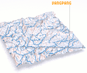 Places with similar names to Văng Păng, Vietnam ::
// Fengping (CN)
// Feng-p'ing (TW)
// Fanggaoping (CN)
// Fangping (CN)
// Fangping (CN)
// Fengpeng (CN)
// Fengping (CN)
Disclaimer :: Information on this page comes without warranty of any kind |
||
|
Where is Văng Păng? Elevation and coordinates ::
Latitude (lat): 19°11'0"N Longitude (lon): 104°51'0"E
Elevation (approx.): 289m (map arrows pan, magnifying glasses zoom) |
||
|
Visiting Văng Păng? Hotel/Accommodation ::
Book a hotel in Văng Păng Travel Guide ::
Buy a travel guide for Vietnam rental cars ::
car rental offers GPS waypoint ::
download a GPX waypoint (PoI) of Văng Păng for your GPS receiver
|
||