|
search place name
|
||
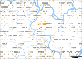
Vạn Tải (Hải Hưng, Vietnam)Vạn Tải is a town in the Hải Hưng region of Vietnam. An overview map of the region around Vạn Tải is displayed below.
regional and 3d topo map of Vạn Tải, Vietnam ::
Vạn Tải airports ::
The nearest airport is HAN - Hanoi Noibai Intl, located 59.1 km north west of Vạn Tải.
Other airports nearby include NNG - Nanning Wuxu (263.1 km north east), Nearby towns ::
Thiên Khê (0.0km north) //
Nam Giang (1.9km south) //
Nhân Lý (1.7km east) //
Ngo Dinh (1.7km west) //
Hùng Thăng (2.5km south west) //
Ðông Hà (2.5km south west) //
Nhân Lễ (3.5km east) //
Hàn Thượng (3.7km south) //
Dục Tr (3.7km north) //
An Lương (3.9km north east) //
Nghĩa Dương (3.9km north east) //
Bạch Ða (3.9km north east) //
Thụy Trà (4.1km north east) //
Mặc Cầu (3.9km north west) //
Ðồng Ngọ (5.1km south east) //
Hảo Hội (5.1km south west) //
Lại Hạ (5.1km north west) //
Hương Trai (5.2km west) //
Ðại Lã (5.6km north) //
Kim Bịch (5.6km north) //
Hải Dương (5.6km south) //
Hoàng Gia (5.5km west) //
Bình Lâu (5.8km south) //
Kính Dương (5.8km north) //
Thanh Cương (5.8km south) //
Linh Khê (6.5km north east) //
Nhân Nghĩa (6.4km south east) //
Ấp Cao Xá (6.4km south west) //
Vũ Xá (6.4km south east) //
[all distances 'as the bird flies' and approximate] 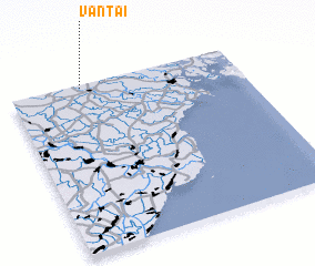 Places with similar names to Vạn Tải, Vietnam ::
Disclaimer :: Information on this page comes without warranty of any kind |
||
|
Where is Vạn Tải? Elevation and coordinates ::
Latitude (lat): 20°59'0"N Longitude (lon): 106°19'0"E
Elevation (approx.): 5m (map arrows pan, magnifying glasses zoom) |
||
|
Visiting Vạn Tải? Hotel/Accommodation ::
Book a hotel in Vạn Tải Travel Guide ::
Buy a travel guide for Vietnam rental cars ::
car rental offers GPS waypoint ::
download a GPX waypoint (PoI) of Vạn Tải for your GPS receiver
|
||