|
search place name
|
||
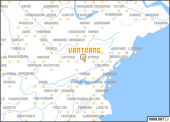
Vân Tràng (Thái Bình, Vietnam)Vân Tràng is a town in the Thái Bình region of Vietnam. An overview map of the region around Vân Tràng is displayed below.
regional and 3d topo map of Vân Tràng, Vietnam ::
Vân Tràng airports ::
The nearest airport is HAN - Hanoi Noibai Intl, located 103.4 km north west of Vân Tràng.
Nearby towns ::
Hoành Sơn (0.0km north) //
An Cúc (1.7km west) //
Kha Lý (1.9km north) //
Vân Am (1.9km north) //
Ô Trình (1.7km east) //
Thượng Phúc (2.5km south west) //
Lại Triều (3.5km west) //
Trà Bôi (3.7km south) //
An Bái (3.5km east) //
Lưu Ðồn (3.5km east) //
Cảm Doài (4.1km south west) //
Nghĩa Chỉ (4.1km south east) //
Vạn Hoạch (4.1km north west) //
Thụy Anh (3.9km south east) //
Thái Thụy (3.9km south east) //
Hoa Thôn (3.9km north east) //
Bích Du (5.1km south east) //
An Dân (5.2km west) //
Tây Am (5.6km north) //
Dong Thon (5.2km east) //
Trung Kinh (5.8km north) //
Ðông Nha Thon (5.8km north) //
Khai Lai (5.8km south) //
Dông Nương Thôn (5.5km east) //
Hà My (5.8km south) //
Ðông Am (5.8km north) //
Nam Am (5.8km north) //
Thùy Dương (5.8km south) //
An Co (5.5km east) //
[all distances 'as the bird flies' and approximate] 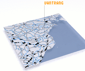 Places with similar names to Vân Tràng, Vietnam ::
// Văn Tràng (VN)
// Văn Trung (VN)
// Van Truong (VN)
// Văn Trường (VN)
// Vĩnh Trường (VN)
// Vĩnh Trường (VN)
Disclaimer :: Information on this page comes without warranty of any kind |
||
|
Where is Vân Tràng? Elevation and coordinates ::
Latitude (lat): 20°35'0"N Longitude (lon): 106°32'0"E
Elevation (approx.): 2m (map arrows pan, magnifying glasses zoom) |
||
|
Visiting Vân Tràng? Hotel/Accommodation ::
Book a hotel in Vân Tràng Travel Guide ::
Buy a travel guide for Vietnam rental cars ::
car rental offers GPS waypoint ::
download a GPX waypoint (PoI) of Vân Tràng for your GPS receiver
|
||