|
search place name
|
||
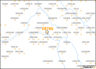
Vay Hú (Vietnam)Vay Hú is a town in Vietnam. An overview map of the region around Vay Hú is displayed below.
regional and 3d topo map of Vay Hú, Vietnam ::
Vay Hú airports ::
The nearest airport is HAN - Hanoi Noibai Intl, located 184.4 km south east of Vay Hú.
Nearby towns ::
Làng Lành (1.7km west) //
Làng Yên (1.9km south) //
Làng Bố (1.7km east) //
Làng Noảng (2.5km south west) //
Làng Phàn (2.5km north east) //
Làng Thi (3.4km east) //
Làng Sung (4.1km south west) //
Làng Châu (3.9km south west) //
Làng Mạ (3.9km north west) //
Phú Sinh Ngày (4.1km north west) //
Lùng Giao (3.9km south east) //
Làng Chu (5.1km south west) //
Khánh Yên Thượng (5.1km south east) //
Làng Giáng (5.2km west) //
Nâm Chấn (5.5km west) //
Làng Uêch (5.8km north) //
Làng Nan (5.8km south) //
Kuoi Tầm Bào (5.5km east) //
Làng Nan (6.3km south west) //
Làng Tình (6.9km east) //
Làng Bài (7.1km west) //
Làng Bà (7.1km west) //
Bản Hành (7.8km north west) //
Tac Ai (8.2km north west) //
Làng Kê (7.8km south east) //
Làng Qua (9.0km south east) //
Côc Bào (8.8km north east) //
Làng Cú (9.0km north east) //
[all distances 'as the bird flies' and approximate] 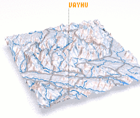 Places with similar names to Vay Hú, Vietnam ::
Disclaimer :: Information on this page comes without warranty of any kind |
||
|
Where is Vay Hú? Elevation and coordinates ::
Latitude (lat): 22°5'0"N Longitude (lon): 104°17'0"E
Elevation (approx.): 194m (map arrows pan, magnifying glasses zoom) |
||
|
Visiting Vay Hú? Hotel/Accommodation ::
Book a hotel in Vay Hú Travel Guide ::
Buy a travel guide for Vietnam rental cars ::
car rental offers GPS waypoint ::
download a GPX waypoint (PoI) of Vay Hú for your GPS receiver
|
||