|
search place name
|
||
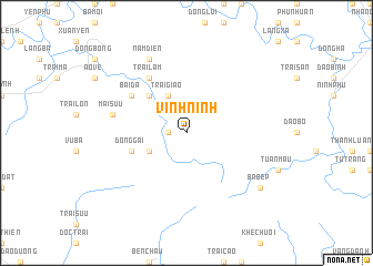
Vĩnh Ninh (Hà Bắc, Vietnam)Vĩnh Ninh is a town in the Hà Bắc region of Vietnam. An overview map of the region around Vĩnh Ninh is displayed below.
regional and 3d topo map of Vĩnh Ninh, Vietnam ::
Vĩnh Ninh airports ::
The nearest airport is HAN - Hanoi Noibai Intl, located 85.8 km west of Vĩnh Ninh.
Other airports nearby include NNG - Nanning Wuxu (220.1 km north east), Nearby towns ::
Hổ Lao (1.7km west) //
Ðám Trì (3.9km south west) //
Trại Giao (4.1km north west) //
Dối Sơn (5.1km north west) //
Ðông Gãi (5.5km west) //
Trại Lam (6.5km north west) //
Bai Da (6.4km north west) //
Mai Sưu (7.2km west) //
Nam Ðiến (8.2km north west) //
Ba Bếp (8.9km south east) //
[all distances 'as the bird flies' and approximate] 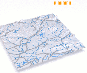 Places with similar names to Vĩnh Ninh, Vietnam ::
Disclaimer :: Information on this page comes without warranty of any kind |
||
|
Where is Vĩnh Ninh? Elevation and coordinates ::
Latitude (lat): 21°14'0"N Longitude (lon): 106°38'0"E
Elevation (approx.): 177m (map arrows pan, magnifying glasses zoom) |
||
|
Visiting Vĩnh Ninh? Hotel/Accommodation ::
Book a hotel in Vĩnh Ninh Travel Guide ::
Buy a travel guide for Vietnam rental cars ::
car rental offers GPS waypoint ::
download a GPX waypoint (PoI) of Vĩnh Ninh for your GPS receiver
|
||