|
search place name
|
||
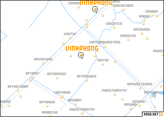
Vĩnh Phong (Kiến Giang, Vietnam)Vĩnh Phong is a town in the Kiến Giang region of Vietnam. An overview map of the region around Vĩnh Phong is displayed below.
regional and 3d topo map of Vĩnh Phong, Vietnam ::
Vĩnh Phong airports ::
The nearest airport is SGN - Ho Chi Minh City Tansonnhat Intl, located 215.6 km north east of Vĩnh Phong.
Nearby towns ::
Líp Ốc (2.7km west) //
Xóm Cạnh Ðền (2.9km east) //
Ấp Cạnh Ðèn (3.8km north east) //
Xóm The (4.9km east) //
Ấp Tân Dương (5.0km south) //
Ấp Vĩnh Tường (5.4km north west) //
Vĩnh Tây (5.5km north west) //
Xóm Trần Quang Tống (5.8km north east) //
Xóm Ngã Tư Cạnh Ðền (5.8km north east) //
Ấp Tân Phước (7.1km south west) //
Kiên Long (7.4km north) //
Xóm Thầy Cai (7.5km east) //
Xóm Cả Chợ (8.1km north) //
Ấp Vĩnh Phước (8.1km north) //
Ấp Vĩnh Ðông (2) (8.1km north) //
Ấp Kinh Xáng (8.8km west) //
Xóm Ðiền Sư Phú (8.9km north) //
Xóm Chọ Hội (9.7km south west) //
Xóm Cây Củi (10.0km north east) //
Phong Thạnh Tây (11.1km south east) //
[all distances 'as the bird flies' and approximate]  Places with similar names to Vĩnh Phong, Vietnam ::
// Fenghuang (CN)
// Vinghing (MM)
// Vang Hang (VN)
// Văn Phong (VN)
// Vĩnh Phong (VN)
// Vĩnh Phong (VN)
// Vĩnh Phương (VN)
// Vĩnh Viên (2) (VN)
// Fenghuang (CN)
// Fenghuang (CN)
Disclaimer :: Information on this page comes without warranty of any kind |
||
|
Where is Vĩnh Phong? Elevation and coordinates ::
Latitude (lat): 9°26'40"N Longitude (lon): 105°15'26"E
Elevation (approx.): 2m (map arrows pan, magnifying glasses zoom) |
||
|
Visiting Vĩnh Phong? Hotel/Accommodation ::
Book a hotel in Vĩnh Phong Travel Guide ::
Buy a travel guide for Vietnam rental cars ::
car rental offers GPS waypoint ::
download a GPX waypoint (PoI) of Vĩnh Phong for your GPS receiver
|
||