|
search place name
|
||
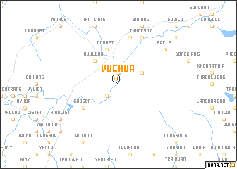
Vũ Chua (Lạng Sơn, Vietnam)Vũ Chua is a town in the Lạng Sơn region of Vietnam. An overview map of the region around Vũ Chua is displayed below.
regional and 3d topo map of Vũ Chua, Vietnam ::
Vũ Chua airports ::
The nearest airport is HAN - Hanoi Noibai Intl, located 64.1 km south west of Vũ Chua.
Other airports nearby include NNG - Nanning Wuxu (225.2 km north east), Nearby towns ::
Trại Nhãn (1.9km north) //
Cu Sơn (2.5km south west) //
Gia Thọ (3.9km north east) //
Hữu Lũng (5.1km north west) //
Ðôn Mệt (5.8km north) //
Cào Sơn (6.4km south west) //
Ðông Thước (7.6km north) //
Thuốc Sơn (8.2km north east) //
Bắc Lê (8.9km north east) //
[all distances 'as the bird flies' and approximate] 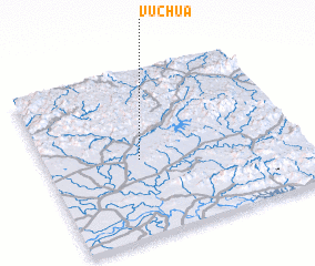 Places with similar names to Vũ Chua, Vietnam ::
Disclaimer :: Information on this page comes without warranty of any kind |
||
|
Where is Vũ Chua? Elevation and coordinates ::
Latitude (lat): 21°28'0"N Longitude (lon): 106°22'0"E
Elevation (approx.): 33m (map arrows pan, magnifying glasses zoom) |
||
|
Visiting Vũ Chua? Hotel/Accommodation ::
Book a hotel in Vũ Chua Travel Guide ::
Buy a travel guide for Vietnam rental cars ::
car rental offers GPS waypoint ::
download a GPX waypoint (PoI) of Vũ Chua for your GPS receiver
|
||