|
search place name
|
||
Xóm Cá Bông (Long An, Vietnam)Xóm Cá Bông is a town in the Long An region of Vietnam. An overview map of the region around Xóm Cá Bông is displayed below.
regional and 3d topo map of Xóm Cá Bông, Vietnam ::

Xóm Cá Bông airports ::
The nearest airport is SGN - Ho Chi Minh City Tansonnhat Intl, located 42.9 km north east of Xóm Cá Bông.
Other airports nearby include PNH - Phnom-penh Phnom Penh Intl (191.0 km north west), Nearby towns ::
Ấp Mỹ Hòa (0.0km north) //
Xóm Dừa (0.0km north) //
Xóm Bà Mía (1.9km north) //
Xóm Bái Gi (2.6km north east) //
Xóm Nhứt Cường (2.6km north west) //
Ấp Bái Bon (2.6km south east) //
Ấp Hòa Lạc (3.6km east) //
Ấp Kinh Bằc Ðông (4.1km south east) //
Ấp Bắc Ðông (5.2km south east) //
Ấp Mỹ Thuận (1) (5.2km north west) //
Ấp Hòa An (5.9km south) //
Xóm Bà Giãi (6.6km north west) //
Mỹ An Phú (6.6km south east) //
Chợ Thầy Yến (7.4km south) //
Xóm Ðêu Cà (7.8km south east) //
Tân Hòa Ðông (7.8km south east) //
Ấp Hội Ngh (7.8km north west) //
Ấp Dăm Thu (8.2km south east) //
Ấp Bình Lương Ðông (8.2km south east) //
Xóm Cây Da (9.2km south east) //
[all distances 'as the bird flies' and approximate] 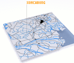 Places with similar names to Xóm Cá Bông, Vietnam ::
// Xóm Cả Bàng (VN)
Disclaimer :: Information on this page comes without warranty of any kind |
||
|
Where is Xóm Cá Bông? Elevation and coordinates ::
Latitude (lat): 10°37'0"N Longitude (lon): 106°19'0"E
Elevation (approx.): 7m (map arrows pan, magnifying glasses zoom) |
||
|
Visiting Xóm Cá Bông? Hotel/Accommodation ::
Book a hotel in Xóm Cá Bông Travel Guide ::
Buy a travel guide for Vietnam rental cars ::
car rental offers GPS waypoint ::
download a GPX waypoint (PoI) of Xóm Cá Bông for your GPS receiver
|
||