|
search place name
|
||
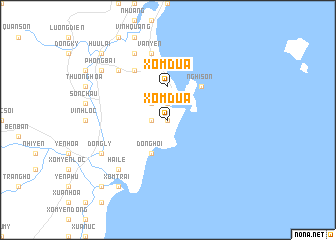
Xóm Dua (Thanh Hóa, Vietnam)Xóm Dua is a town in the Thanh Hóa region of Vietnam. An overview map of the region around Xóm Dua is displayed below.
regional and 3d topo map of Xóm Dua, Vietnam ::
Xóm Dua airports ::
The nearest airport is HAN - Hanoi Noibai Intl, located 212.7 km north of Xóm Dua.
Nearby towns ::
Xóm Ðon (0.0km north) //
Hà Nẫm (1.9km north) //
Xóm Tran (1.7km west) //
Xóm Tên (2.5km north west) //
Yên Hoa Thương (2.5km north west) //
Xóm Dữa (3.7km north) //
Ðộng Hội (4.1km south west) //
Nghi Sơn (5.1km north east) //
Ngọc Ðường (6.6km north west) //
Văn Yên (7.6km north) //
Cao Lư (7.6km north) //
Mậu Thung (7.6km north west) //
Hải Lễ (7.6km south west) //
Chỉ Trung (7.6km north west) //
Trung Dịch (8.2km north west) //
Kim Cốc (8.2km north west) //
Dồng Lý (7.9km south west) //
Xóm Trại (9.1km south west) //
Hữu Lập (9.1km south west) //
Phong Bái (8.9km north west) //
Hữu Lại (10.2km north west) //
Phương Cần (10.2km south west) //
[all distances 'as the bird flies' and approximate]  Places with similar names to Xóm Dua, Vietnam ::
Disclaimer :: Information on this page comes without warranty of any kind |
||
|
Where is Xóm Dua? Elevation and coordinates ::
Latitude (lat): 19°18'0"N Longitude (lon): 105°48'0"E
Elevation (approx.): 153m (map arrows pan, magnifying glasses zoom) |
||
|
Visiting Xóm Dua? Hotel/Accommodation ::
Book a hotel in Xóm Dua Travel Guide ::
Buy a travel guide for Vietnam rental cars ::
car rental offers GPS waypoint ::
download a GPX waypoint (PoI) of Xóm Dua for your GPS receiver
|
||