|
search place name
|
||
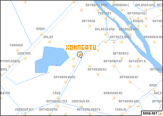
Xóm Ngã Tư (An Giang, Vietnam)Xóm Ngã Tư is a town in the An Giang region of Vietnam. An overview map of the region around Xóm Ngã Tư is displayed below.
regional and 3d topo map of Xóm Ngã Tư, Vietnam ::
Xóm Ngã Tư airports ::
The nearest airport is SGN - Ho Chi Minh City Tansonnhat Intl, located 146.0 km north east of Xóm Ngã Tư.
Other airports nearby include PNH - Phnom-penh Phnom Penh Intl (166.2 km north west), Nearby towns ::
Ấp Thạnh Qứi (1.8km west) //
Ấp An Thới (1.9km north) //
Ấp Thạnh Bình (2.6km south west) //
Ấp Thạnh Phú (2.6km south east) //
Ấp Thạnh Lơi (2) (2.6km north east) //
Ấp An Khương (4.1km north east) //
Ấp Thới Hòa (6) (5.2km south east) //
Ấp Thạnh Hưng (6.7km south west) //
Ấp Phụng Thuạn (6.6km north east) //
Ấp Tân Bình (5) (7.5km east) //
Ấp Tràng (7.6km north) //
Ấp Lân Thạnh (7.8km north east) //
Ấp Lân (8.2km north west) //
Ấp Tân Lợi (2) (8.2km north east) //
[all distances 'as the bird flies' and approximate]  Places with similar names to Xóm Ngã Tư, Vietnam ::
// Semangat (ID)
// Semangut (ID)
// Sam Nkutu (ZM)
// Samankidi (ML)
// Samankoto (ML)
// Samankoto (GN)
// Zamboanguita (PH)
// Xóm Ngã Tư (VN)
// Xóm Ông Ðều (VN)
// Xóm Ông Ðô (VN)
Disclaimer :: Information on this page comes without warranty of any kind |
||
|
Where is Xóm Ngã Tư? Elevation and coordinates ::
Latitude (lat): 10°11'0"N Longitude (lon): 105°29'0"E
Elevation (approx.): 5m (map arrows pan, magnifying glasses zoom) |
||
|
Visiting Xóm Ngã Tư? Hotel/Accommodation ::
Book a hotel in Xóm Ngã Tư Travel Guide ::
Buy a travel guide for Vietnam rental cars ::
car rental offers GPS waypoint ::
download a GPX waypoint (PoI) of Xóm Ngã Tư for your GPS receiver
|
||