|
search place name
|
||
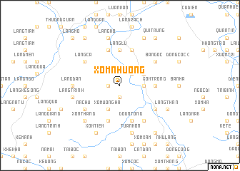
Xóm Nhương (Thanh Hóa, Vietnam)Xóm Nhương is a town in the Thanh Hóa region of Vietnam. An overview map of the region around Xóm Nhương is displayed below.
regional and 3d topo map of Xóm Nhương, Vietnam ::
Xóm Nhương airports ::
The nearest airport is HAN - Hanoi Noibai Intl, located 163.9 km north of Xóm Nhương.
Nearby towns ::
Ðồng Trieng (1.7km west) //
Xóm An (1.7km west) //
Xóm Bản (1.9km south) //
Ðồng Lãm (1.9km south) //
Xóm Giữa (1.9km south) //
Làng Trường (2.5km north east) //
Ðông Trác (3.5km east) //
Xóm Uông Hạ (4.1km south west) //
Khê Hạ (3.9km north east) //
Ðồng Bống (3.9km north east) //
Xóm Trong (5.2km east) //
Làng Lú (5.6km north) //
Làng Bai (5.8km north) //
Ðồng Nàng (2) (5.8km south) //
Doun Tong (5.8km south) //
Làng Cau (5.8km north) //
Xóm Dươi (5.8km south) //
Ba Ngọc (6.4km north east) //
Làng Ca (6.4km north west) //
Làng Mỹ (6.4km south west) //
Na Chu (6.4km south west) //
Làng Giá (6.4km south east) //
Ðông Tân (6.6km south east) //
Làng Ðan (7.0km west) //
Tuân Môn (7.6km south) //
Làng Ho (7.6km north) //
Làng Trinh (7.2km west) //
Làng Ðái (7.2km west) //
Làng Ao (7.6km north) //
[all distances 'as the bird flies' and approximate]  Places with similar names to Xóm Nhương, Vietnam ::
Disclaimer :: Information on this page comes without warranty of any kind |
||
|
Where is Xóm Nhương? Elevation and coordinates ::
Latitude (lat): 19°48'0"N Longitude (lon): 105°22'0"E
Elevation (approx.): 38m (map arrows pan, magnifying glasses zoom) |
||
|
Visiting Xóm Nhương? Hotel/Accommodation ::
Book a hotel in Xóm Nhương Travel Guide ::
Buy a travel guide for Vietnam rental cars ::
car rental offers GPS waypoint ::
download a GPX waypoint (PoI) of Xóm Nhương for your GPS receiver
|
||