|
search place name
|
||
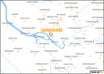
Xóm Ông Ra (1) (Kiến Giang, Vietnam)Xóm Ông Ra (1) is a town in the Kiến Giang region of Vietnam. An overview map of the region around Xóm Ông Ra (1) is displayed below.
regional and 3d topo map of Xóm Ông Ra (1), Vietnam ::
Xóm Ông Ra (1) airports ::
The nearest airport is SGN - Ho Chi Minh City Tansonnhat Intl, located 192.7 km north east of Xóm Ông Ra (1).
Other airports nearby include PNH - Phnom-penh Phnom Penh Intl (208.7 km north), Nearby towns ::
Gò Quao (1.9km north west) //
Vĩnh Tuy (3.0km south) //
Hương Thọ (3.5km north east) //
Vĩnh Phước (4.2km north) //
Sóc Cạn (4.3km north east) //
Xóm Xèo Gia (4.4km south west) //
Xóm Chợ (4.6km east) //
Xóm Mó Thi Cu (4.6km west) //
Ấp Thu Hồ (4.8km north east) //
Xóm Cô Sáu (5.5km south east) //
Xóm Ðương Ðạo (5.9km south) //
Ấp Rạch Tìa (6.4km north) //
Ðịnh Hòa (6.7km north west) //
Ấp Lục (7.0km north east) //
Ấp Tà Mum (7.7km north west) //
Ấp Tà Ðôn (7.9km north east) //
Ấp Cà Nhung (8.4km north) //
Vĩnh Hòa Hưng (8.4km east) //
Xóm Lò Gạch (8.7km east) //
Ấp Kè Một (8.7km south west) //
Xóm Vam Cai Ban (8.7km west) //
Xóm Thổ Mây (10.0km north east) //
Xóm Béc Trang (10.4km south east) //
[all distances 'as the bird flies' and approximate] 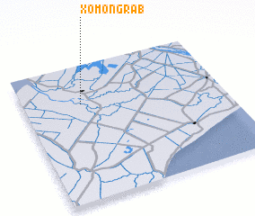 Places with similar names to Xóm Ông Ra (1), Vietnam :: Disclaimer :: Information on this page comes without warranty of any kind |
||
|
Where is Xóm Ông Ra (1)? Elevation and coordinates ::
Latitude (lat): 9°42'45"N Longitude (lon): 105°17'36"E
Elevation (approx.): -1m (map arrows pan, magnifying glasses zoom) |
||
|
Visiting Xóm Ông Ra (1)? Hotel/Accommodation ::
Book a hotel in Xóm Ông Ra (1) Travel Guide ::
Buy a travel guide for Vietnam rental cars ::
car rental offers GPS waypoint ::
download a GPX waypoint (PoI) of Xóm Ông Ra (1) for your GPS receiver
|
||