|
search place name
|
||
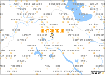
Xóm Tám Người (Vietnam)Xóm Tám Người is a town in Vietnam. An overview map of the region around Xóm Tám Người is displayed below.
regional and 3d topo map of Xóm Tám Người, Vietnam ::
Xóm Tám Người airports ::
The nearest airport is HAN - Hanoi Noibai Intl, located 102.3 km south east of Xóm Tám Người.
Nearby towns ::
Gô Công (0.0km north) //
Hậu Bổng (1.9km south) //
Bình Lục (1.9km north) //
Ðạn Hà (2.5km south west) //
Xóm Ðồng (1) (2.5km north west) //
Ðồng Lũng (2.5km south east) //
Xóm Lương (3.4km west) //
Lương Sơn (3.7km north) //
Chà Hạ (4.1km south west) //
Trung Thừa (4.1km north west) //
Ðức Quân (3.9km south west) //
Sóm Ðoa (3.9km south west) //
Ðan Thượng (4.1km south east) //
Xóm Ðồng (2) (3.9km north east) //
Văn Lãng (3.9km north east) //
Xóm Sãi (5.1km north west) //
Nàng Sa (5.6km south) //
Ðông Lâm (5.6km south) //
Tuần Quán (5.8km north) //
Văn Qui (5.8km north) //
Xóm Trung (5.5km east) //
Hiền Lương (6.5km south west) //
Xóm Soi (1) (6.5km north west) //
Hồ Mai (6.5km north west) //
Y Sơn (6.5km south east) //
Lam Lợi (6.5km south east) //
Lệnh Khanh (6.5km south east) //
Lâm Thôn (6.5km north east) //
Xóm Thượng (6.9km east) //
[all distances 'as the bird flies' and approximate] 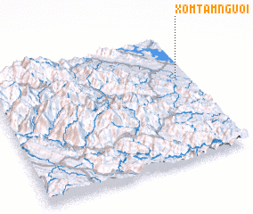 Places with similar names to Xóm Tám Người, Vietnam ::
// Sumdum Nok (MM)
Disclaimer :: Information on this page comes without warranty of any kind |
||
|
Where is Xóm Tám Người? Elevation and coordinates ::
Latitude (lat): 21°39'0"N Longitude (lon): 104°56'0"E
Elevation (approx.): 45m (map arrows pan, magnifying glasses zoom) |
||
|
Visiting Xóm Tám Người? Hotel/Accommodation ::
Book a hotel in Xóm Tám Người Travel Guide ::
Buy a travel guide for Vietnam rental cars ::
car rental offers GPS waypoint ::
download a GPX waypoint (PoI) of Xóm Tám Người for your GPS receiver
|
||