|
search place name
|
||
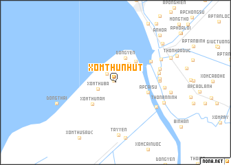
Xóm Thứ Nhưt (Kiến Giang, Vietnam)Xóm Thứ Nhưt is a town in the Kiến Giang region of Vietnam. An overview map of the region around Xóm Thứ Nhưt is displayed below.
regional and 3d topo map of Xóm Thứ Nhưt, Vietnam ::
Xóm Thứ Nhưt airports ::
The nearest airport is PNH - Phnom-penh Phnom Penh Intl, located 183.8 km north of Xóm Thứ Nhưt.
Other airports nearby include SGN - Ho Chi Minh City Tansonnhat Intl (202.7 km north east), Nearby towns ::
Tây Yên (0.4km north west) //
Xóm Xẻo Ginh (2.0km north west) //
Xóm Kinh Dài (2.2km north) //
Xóm Thư Ba (3.0km west) //
Xóm Kinh Vịnh Phong (3.6km north east) //
Ðông Yên (4.3km north) //
Xóm Ba Luân (4.7km north east) //
Xóm Thứ Năm (5.1km south west) //
Ấp Cái Su (5.5km east) //
Huyện Châu Thành (6.6km north east) //
Thôn Vĩnh Qứi (7.1km east) //
Ấp Vĩnh Lợi (2) (7.1km east) //
Thôn Vĩnh Thành (7.1km east) //
Vĩnh Hòa Hiệp (7.4km east) //
Kiên An (7.7km south east) //
Xóm Thứ Năm (7.9km east) //
Ấp Vĩnh Lợi (1) (8.2km north east) //
Tây Yên (8.5km south) //
Thôn An Ninh (8.4km south east) //
Ap Rạch Soi (9.8km north east) //
An Hòa (10.4km north east) //
[all distances 'as the bird flies' and approximate] 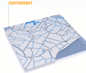 Places with similar names to Xóm Thứ Nhưt, Vietnam :: Disclaimer :: Information on this page comes without warranty of any kind |
||
|
Where is Xóm Thứ Nhưt? Elevation and coordinates ::
Latitude (lat): 9°53'51"N Longitude (lon): 105°3'8"E
Elevation (approx.): 2m (map arrows pan, magnifying glasses zoom) |
||
|
Visiting Xóm Thứ Nhưt? Hotel/Accommodation ::
Book a hotel in Xóm Thứ Nhưt Travel Guide ::
Buy a travel guide for Vietnam rental cars ::
car rental offers GPS waypoint ::
download a GPX waypoint (PoI) of Xóm Thứ Nhưt for your GPS receiver
|
||