|
search place name
|
||
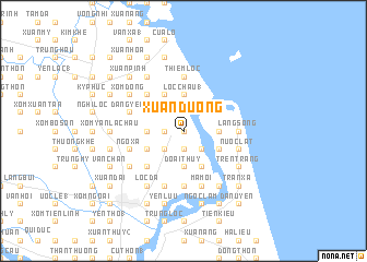
Xuân Dương (Vietnam)Xuân Dương is a town in Vietnam. An overview map of the region around Xuân Dương is displayed below.
regional and 3d topo map of Xuân Dương, Vietnam ::
Xuân Dương airports ::
The nearest airport is SNO - Sakon Nakhon, located 241.3 km south west of Xuân Dương.
Nearby towns ::
Nam Sơn (0.0km north) //
My Loc (0.0km north) //
Hòa Cam (1.8km west) //
Cổ Ðan (1.9km south) //
Phúc Lợi (1.9km south) //
Ðan Dién (2.6km south west) //
Lộc Tho (2.6km south east) //
Lộc Châu (1) (2.6km north east) //
Phương Cương (3.5km west) //
Doài Thụy (3.7km south) //
Lộc Châu (1) (3.7km north) //
Hải Yên (3.7km north) //
Hộ Thông (3.5km east) //
Phú Vinh (4.0km south west) //
Văn Trạch (4.0km south west) //
Mỹ Chiên (4.0km north west) //
Hỏi Côn (4.1km south east) //
Lập Thach (4.1km north west) //
Ðan Trường (4.0km south east) //
Ðông Thương (4.0km north east) //
Duc Thinh (5.1km south west) //
Ðông Chu (5.1km north west) //
Thiêm Lộc (5.6km north) //
Làng Song (5.3km east) //
Mỹ Yên (5.6km north) //
Giáp Vinh Yên (5.6km north) //
Xóm Cư Phú (5.6km south) //
Nươc Lat (5.6km east) //
Ngô Xa (5.6km west) //
[all distances 'as the bird flies' and approximate]  Places with similar names to Xuân Dương, Vietnam ::
Disclaimer :: Information on this page comes without warranty of any kind |
||
|
Where is Xuân Dương? Elevation and coordinates ::
Latitude (lat): 18°44'0"N Longitude (lon): 105°44'0"E
Elevation (approx.): 5m (map arrows pan, magnifying glasses zoom) |
||
|
Visiting Xuân Dương? Hotel/Accommodation ::
Book a hotel in Xuân Dương Travel Guide ::
Buy a travel guide for Vietnam rental cars ::
car rental offers GPS waypoint ::
download a GPX waypoint (PoI) of Xuân Dương for your GPS receiver
|
||