|
search place name
|
||
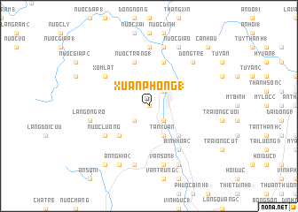
Xuân Phong (1) (Vietnam)Xuân Phong (1) is a town in Vietnam. An overview map of the region around Xuân Phong (1) is displayed below.
regional and 3d topo map of Xuân Phong (1), Vietnam ::
Xuân Phong (1) airports ::
The nearest airport is DAD - Danang Intl, located 180.9 km north west of Xuân Phong (1).
Nearby towns ::
Nước Con (0.0km north) //
Ðá Hàn (2.6km south west) //
An Lão (2.6km north east) //
Hưng Long (1) (2.6km north east) //
Long Khánh (1) (2.6km south east) //
Tân Xuân (4.1km south east) //
Lang Lai Ðâ Han (5.2km south west) //
Long Khánh (3) (5.2km south east) //
Nước Trang (1) (5.8km north) //
Hưng Nhơn (5.8km north) //
Xóm Lát (6.5km north west) //
Nước Lương (6.5km south west) //
Bình Hòa (2) (6.6km south east) //
Bình Hòa (6.6km south east) //
Hóc Khoan (7.4km north) //
Lăng Ông Ro (7.4km west) //
Lang Ba Lanh (7.6km south) //
Hóc Ðien (7.6km north) //
Văn Sơn (1) (7.6km south) //
Dong Trè (7.7km north east) //
An Nghĩa (2) (8.2km south west) //
Nước Giao (8.2km north east) //
Văn Hòa (8.2km south east) //
Cam Ðức (1) (8.2km south east) //
An Nghĩa (1) (9.2km south west) //
Cấn Hậu (10.3km north east) //
[all distances 'as the bird flies' and approximate] 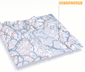 Places with similar names to Xuân Phong (1), Vietnam ::
// Xuân Phương (1) (VN)
// Xuân Phương (1) (VN)
Disclaimer :: Information on this page comes without warranty of any kind |
||
|
Where is Xuân Phong (1)? Elevation and coordinates ::
Latitude (lat): 14°33'0"N Longitude (lon): 108°53'0"E
Elevation (approx.): 56m (map arrows pan, magnifying glasses zoom) |
||
|
Visiting Xuân Phong (1)? Hotel/Accommodation ::
Book a hotel in Xuân Phong (1) Travel Guide ::
Buy a travel guide for Vietnam rental cars ::
car rental offers GPS waypoint ::
download a GPX waypoint (PoI) of Xuân Phong (1) for your GPS receiver
|
||