|
search place name
|
||
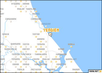
Yên Ðiềm (Vietnam)Yên Ðiềm is a town in Vietnam. An overview map of the region around Yên Ðiềm is displayed below.
regional and 3d topo map of Yên Ðiềm, Vietnam ::
Yên Ðiềm airports ::
The nearest airport is SNO - Sakon Nakhon, located 237.4 km south west of Yên Ðiềm.
Other airports nearby include ZVK - Savannakhet (247.6 km south west), Nearby towns ::
Trung Thịnh (2.6km south west) //
Ðộng Gian (4.1km north west) //
Nghi Lộc (4.0km north west) //
Ham Anh (4.0km south west) //
Kim Chùy (4.1km south west) //
Yên Dịnh (5.1km south west) //
Lộc Nguyên (5.1km south west) //
Yen Tập (5.3km west) //
Binh Nguyên (5.8km south) //
Thượng Yên (6.6km south west) //
Vinh Hoa (6.6km south west) //
Kim Ðôi (6.6km south east) //
Chi Nê (6.4km south west) //
Mâu Vien (7.6km south) //
Xuan Hải (7.6km south) //
Ðại Lự (7.7km south west) //
Cương Giẩn (7.7km north west) //
Phu Lưu Thượng (7.9km south west) //
Ich Hau (8.2km south west) //
Thanh Lương (8.2km south west) //
Xuan Khánh (8.2km south east) //
Trung Nghỉa (8.2km south east) //
Ðỉnh Lụ (7.9km south east) //
Phu Hau (9.1km north west) //
Lương Ðiền (10.2km south west) //
Hòa Lộc (10.2km south west) //
[all distances 'as the bird flies' and approximate] 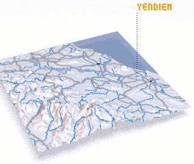 Places with similar names to Yên Ðiềm, Vietnam ::
Disclaimer :: Information on this page comes without warranty of any kind |
||
|
Where is Yên Ðiềm? Elevation and coordinates ::
Latitude (lat): 18°31'0"N Longitude (lon): 105°53'0"E
Elevation (approx.): -32768m (map arrows pan, magnifying glasses zoom) |
||
|
Visiting Yên Ðiềm? Hotel/Accommodation ::
Book a hotel in Yên Ðiềm Travel Guide ::
Buy a travel guide for Vietnam rental cars ::
car rental offers GPS waypoint ::
download a GPX waypoint (PoI) of Yên Ðiềm for your GPS receiver
|
||