|
search place name
|
||
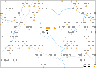
Yên Hùng (Lạng Sơn, Vietnam)Yên Hùng is a town in the Lạng Sơn region of Vietnam. An overview map of the region around Yên Hùng is displayed below.
regional and 3d topo map of Yên Hùng, Vietnam ::
Yên Hùng airports ::
The nearest airport is HAN - Hanoi Noibai Intl, located 102.1 km south west of Yên Hùng.
Other airports nearby include NNG - Nanning Wuxu (211.9 km east), Nearby towns ::
Ba Biên (1.9km south) //
Báo Thiên (1.7km west) //
Na Mon (1.7km west) //
Na Ton (5.5km east) //
Bắc Hóa (6.5km south west) //
Kouei Cao (6.5km south west) //
Ba Tang (7.1km west) //
Sack Sai (7.6km north west) //
Na Lao (7.8km north east) //
Khuôi Hap (7.8km south east) //
Na Quang (9.0km north west) //
Pac Ya (8.8km south east) //
Na Lao (8.8km south west) //
Na Loc (2) (8.8km south east) //
[all distances 'as the bird flies' and approximate] 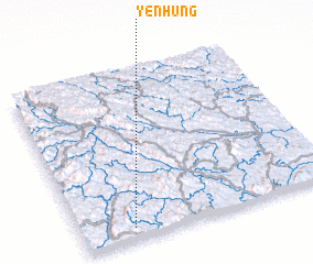 Places with similar names to Yên Hùng, Vietnam ::
Disclaimer :: Information on this page comes without warranty of any kind |
||
|
Where is Yên Hùng? Elevation and coordinates ::
Latitude (lat): 22°4'0"N Longitude (lon): 106°12'0"E
Elevation (approx.): 397m (map arrows pan, magnifying glasses zoom) |
||
|
Visiting Yên Hùng? Hotel/Accommodation ::
Book a hotel in Yên Hùng Travel Guide ::
Buy a travel guide for Vietnam rental cars ::
car rental offers GPS waypoint ::
download a GPX waypoint (PoI) of Yên Hùng for your GPS receiver
|
||