|
search place name
|
||
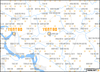
Yên Tào (Hải Hưng, Vietnam)Yên Tào is a town in the Hải Hưng region of Vietnam. An overview map of the region around Yên Tào is displayed below.
regional and 3d topo map of Yên Tào, Vietnam ::
Yên Tào airports ::
The nearest airport is HAN - Hanoi Noibai Intl, located 71.3 km north west of Yên Tào.
Other airports nearby include NNG - Nanning Wuxu (296.3 km north east), Nearby towns ::
Ðiềm Xá (1.9km south) //
Hoàng Xá (1.7km west) //
Canh Hoạch (1.7km west) //
Nại Khê (1.7km east) //
Van Xá (1.7km east) //
Ðình Cao (2.5km north east) //
Hiệu Vũ (3.7km south) //
Thụy Lôi (3.9km south west) //
Võng Phàn (4.1km south east) //
Xóm Ha (4.1km north west) //
Phù Anh (3.9km south east) //
Ðông Cáp (4.1km north west) //
Cát Dương (4.1km north east) //
Hoàng Các (3.9km north east) //
Mỹ Dộng (3.9km north east) //
An Cầu (5.1km south east) //
Tam Ða (5.2km east) //
Cảo Xá (5.6km north) //
Trần Xá (5.6km north) //
Hai Yen (5.5km west) //
Tảo Son (5.8km south) //
Long Cầu (5.8km north) //
Hà Phai (5.8km south) //
Xuân Truc (6.6km south west) //
Hoàng Tranh (6.6km north west) //
Canh Nông (6.4km south east) //
Phương Dương (6.4km north east) //
Trình Xá (6.4km north west) //
Ngũ Lão (6.6km north east) //
[all distances 'as the bird flies' and approximate] 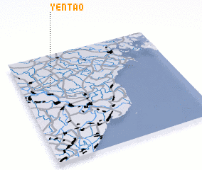 Places with similar names to Yên Tào, Vietnam ::
Disclaimer :: Information on this page comes without warranty of any kind |
||
|
Where is Yên Tào? Elevation and coordinates ::
Latitude (lat): 20°41'0"N Longitude (lon): 106°11'0"E
Elevation (approx.): 6m (map arrows pan, magnifying glasses zoom) |
||
|
Visiting Yên Tào? Hotel/Accommodation ::
Book a hotel in Yên Tào Travel Guide ::
Buy a travel guide for Vietnam rental cars ::
car rental offers GPS waypoint ::
download a GPX waypoint (PoI) of Yên Tào for your GPS receiver
|
||