|
search place name
|
||
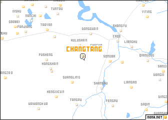
Changtang (Zhejiang, China)Changtang is a town in the Zhejiang region of China. An overview map of the region around Changtang is displayed below.
regional and 3d topo map of Changtang, China ::
Changtang airports ::
The nearest airport is HGH - Hangzhou Xiaoshan, located 46.3 km north west of Changtang.
Other airports nearby include NGB - Ninbo Lishe (65.7 km east), SHA - Shanghai Hongqiao Intl (147.0 km north), NKG - Nanjing Lukou (271.1 km north west), Nearby towns ::
Hulushan (3.3km north) //
Checun (3.3km north east) //
Guangling (5.4km south west) //
Songba (5.0km east) //
Dongguan (6.0km north) //
Shangpu (7.1km south east) //
Shangwang (6.7km west) //
Hongshan (6.8km west) //
Fusheng (7.2km west) //
Hengdan (7.7km north west) //
Nanxue (7.5km east) //
Cao'e (7.8km north east) //
Hengxicun (9.8km south west) //
Shangyu (9.7km north east) //
Taoyan (9.8km north west) //
[all distances 'as the bird flies' and approximate] 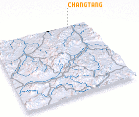 Places with similar names to Changtang, China ::
// Shangdang (MM)
// Chingtang (IN)
// Ch'ang-dong (KP)
// Ch'ang-dong (KP)
// Ch'ang-dong (KP)
// Ch'ang-dong (KP)
// Ch'ang-dong (KP)
// Ch'ang-dong (KP)
// Ch'ang-dong (KP)
// Ch'ang-dong (KP)
Disclaimer :: Information on this page comes without warranty of any kind |
||
|
Where is Changtang? Elevation and coordinates ::
Latitude (lat): 29°57'23"N Longitude (lon): 120°47'52"E
Elevation (approx.): 10m (map arrows pan, magnifying glasses zoom) |
||
|
Visiting Changtang? Hotel/Accommodation ::
Book a hotel in Changtang Travel Guide ::
Buy a travel guide for China rental cars ::
car rental offers GPS waypoint ::
download a GPX waypoint (PoI) of Changtang for your GPS receiver
|
||