|
search place name
|
||
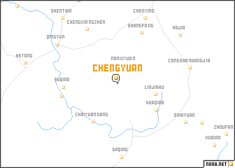
Chengyuan (Jiangxi, China)Chengyuan is a town in the Jiangxi region of China. An overview map of the region around Chengyuan is displayed below.
regional and 3d topo map of Chengyuan, China ::
Chengyuan airports ::
The nearest airport is KHN - Nanchang Changbei Intl, located 112.3 km west of Chengyuan.
Nearby towns ::
Nanxiyuan (3.1km north) //
Linjiawu (5.6km east) //
Chaiyuandang (7.0km south west) //
Huaqiao (6.9km south east) //
Suqiao (7.6km west) //
Shangfang (8.9km north east) //
Chengxiangzhen (9.7km north west) //
[all distances 'as the bird flies' and approximate]  Places with similar names to Chengyuan, China ::
// Shanagyin (MM)
// Shangyun (MM)
// Chiang Yun (TH)
// Chungyŏn (KP)
// Chŏngyŏn-ni (KR)
// Chengyuan (CN)
// Shangyan (CN)
// Chung-yüan (TW)
// Ch'ang-yüan (TW)
// Ching-yüan (TW)
Disclaimer :: Information on this page comes without warranty of any kind |
||
|
Where is Chengyuan? Elevation and coordinates ::
Latitude (lat): 28°36'17"N Longitude (lon): 117°0'39"E
Elevation (approx.): 90m (map arrows pan, magnifying glasses zoom) |
||
|
Visiting Chengyuan? Hotel/Accommodation ::
Book a hotel in Chengyuan Travel Guide ::
Buy a travel guide for China rental cars ::
car rental offers GPS waypoint ::
download a GPX waypoint (PoI) of Chengyuan for your GPS receiver
|
||