|
search place name
|
||
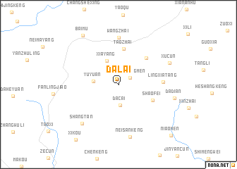
Dalai (Zhejiang, China)Dalai is a town in the Zhejiang region of China. An overview map of the region around Dalai is displayed below.
regional and 3d topo map of Dalai, China ::
Dalai airports ::
The nearest airport is HGH - Hangzhou Xiaoshan, located 177.1 km north east of Dalai.
Other airports nearby include NGB - Ninbo Lishe (207.6 km north east), Nearby towns ::
Dongyangmen (2.0km north east) //
Dacai (3.3km south) //
Yuyuan (3.5km west) //
Xiayang (4.0km north west) //
Taozhai (5.7km north) //
Shaofei (5.4km south east) //
Shangsibao (5.6km north east) //
Lingxiatang (6.2km east) //
Wangzhai (7.4km north) //
Shangtan (7.9km south west) //
Neisankeng (8.5km south) //
Xucun (7.9km north east) //
Dadian (8.1km east) //
Baimu (9.2km north west) //
Xikou (10.6km south west) //
Niaomen (10.9km south east) //
[all distances 'as the bird flies' and approximate] 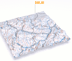 Places with similar names to Dalai, China ::
Disclaimer :: Information on this page comes without warranty of any kind |
||
|
Where is Dalai? Elevation and coordinates ::
Latitude (lat): 28°46'0"N Longitude (lon): 119°42'0"E
Elevation (approx.): 851m (map arrows pan, magnifying glasses zoom) |
||
|
Visiting Dalai? Hotel/Accommodation ::
Book a hotel in Dalai Travel Guide ::
Buy a travel guide for China rental cars ::
car rental offers GPS waypoint ::
download a GPX waypoint (PoI) of Dalai for your GPS receiver
|
||