|
search place name
|
||
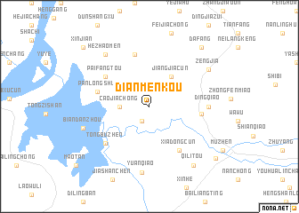
Dianmenkou (Anhui, China)Dianmenkou is a town in the Anhui region of China. An overview map of the region around Dianmenkou is displayed below.
regional and 3d topo map of Dianmenkou, China ::
Dianmenkou airports ::
The nearest airport is HFE - Hefei Luogang, located 124.0 km north west of Dianmenkou.
Other airports nearby include NKG - Nanjing Lukou (144.9 km north east), KHN - Nanchang Changbei Intl (282.8 km south west), Nearby towns ::
Sunlong (2.0km south west) //
Caojiachong (3.2km west) //
Jiangjiacun (4.4km north east) //
Dingqiaozhen (5.7km east) //
Paifangtou (6.0km north west) //
Xiadongcun (6.4km south east) //
Panlongshu (5.9km west) //
Dongdian (6.7km north) //
Tongbuzhen (6.7km south west) //
Dingqiao (6.4km east) //
Yuanqiao (8.4km south) //
Hezhaomen (8.1km north west) //
Zengjia (7.9km north east) //
Biandanzhou (7.7km west) //
Qilitou (8.8km south east) //
Dafang (9.3km north east) //
Louwu (9.7km south east) //
Xinjian (10.3km north west) //
[all distances 'as the bird flies' and approximate]  Places with similar names to Dianmenkou, China ::
// Tanmbongou (BF)
// Dan Manga (TD)
// Dono Manga (TD)
// Tinambung (ID)
// Tinmaung (MM)
// Tunmöng (MM)
// Tünmöng (MM)
// Tiên Mung (VN)
// Tanimainiku (KI)
Disclaimer :: Information on this page comes without warranty of any kind |
||
|
Where is Dianmenkou? Elevation and coordinates ::
Latitude (lat): 30°46'0"N Longitude (lon): 117°51'0"E
Elevation (approx.): 41m (map arrows pan, magnifying glasses zoom) |
||
|
Visiting Dianmenkou? Hotel/Accommodation ::
Book a hotel in Dianmenkou Travel Guide ::
Buy a travel guide for China rental cars ::
car rental offers GPS waypoint ::
download a GPX waypoint (PoI) of Dianmenkou for your GPS receiver
|
||