|
search place name
|
||
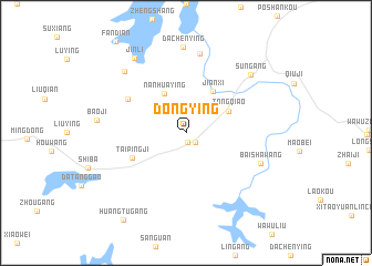
Dongying (Anhui, China)Dongying is a town in the Anhui region of China. An overview map of the region around Dongying is displayed below.
regional and 3d topo map of Dongying, China ::
Dongying airports ::
The nearest airport is NKG - Nanjing Lukou, located 131.1 km south east of Dongying.
Other airports nearby include HFE - Hefei Luogang (140.7 km south west), Nearby towns ::
Zhangying (1.0km south) //
Lushan (1.2km south east) //
Nanhuaying (4.4km north west) //
Tongqiao (4.2km north east) //
Jianxi (4.8km north east) //
Taipingji (5.2km south west) //
Gaozaofang (6.0km north west) //
Jiutangyang (8.1km north) //
Baishawang (7.0km south east) //
Dachenying (8.7km north) //
Xiahuangli (8.1km north west) //
Sungang (8.0km north east) //
Jinli (8.7km north west) //
Huangtugang (10.2km south west) //
[all distances 'as the bird flies' and approximate] 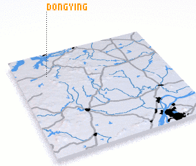 Places with similar names to Dongying, China ::
// Tangyaung (MM)
// Taungyaung (MM)
// Taungyaung (MM)
// Tongyang (KP)
// T'ongyŏng (KR)
// Tang Young (LA)
// Dangyang (CN)
// Dongyang (CN)
// Ting-ying (TW)
// Hteingyaung (MM)
Disclaimer :: Information on this page comes without warranty of any kind |
||
|
Where is Dongying? Elevation and coordinates ::
Latitude (lat): 32°47'10"N Longitude (lon): 118°12'30"E
Elevation (approx.): 30m (map arrows pan, magnifying glasses zoom) |
||
|
Visiting Dongying? Hotel/Accommodation ::
Book a hotel in Dongying Travel Guide ::
Buy a travel guide for China rental cars ::
car rental offers GPS waypoint ::
download a GPX waypoint (PoI) of Dongying for your GPS receiver
|
||