|
search place name
|
||
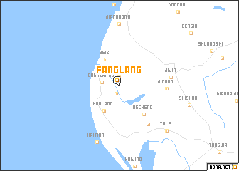
Fanglang (Guangdong, China)Fanglang is a town in the Guangdong region of China. An overview map of the region around Fanglang is displayed below.
regional and 3d topo map of Fanglang, China ::
Fanglang airports ::
The nearest airport is NNG - Nanning Wuxu, located 243.7 km north west of Fanglang.
Nearby towns ::
Zhoujia (1.3km south west) //
Baojin (1.4km north) //
Guanzhang (2.6km west) //
Haolang (4.5km south west) //
Beizi (4.6km north west) //
Hecheng (5.8km south east) //
Jinpan (6.9km east) //
Qugangxu (7.4km south east) //
Jijia (7.7km east) //
Tule (10.0km south east) //
[all distances 'as the bird flies' and approximate]  Places with similar names to Fanglang, China ::
// Phianglouang (LA)
// Vang Long (LA)
// Feng-lin-k'ou (TW)
// Vanklang (MM)
// Fieng Loung (VN)
// Phiang Louong (VN)
// Phong Lãnh (2) (VN)
// Phương Lăng (VN)
// Vang Lang (VN)
// Fanglong (CN)
Disclaimer :: Information on this page comes without warranty of any kind |
||
|
Where is Fanglang? Elevation and coordinates ::
Latitude (lat): 20°56'12"N Longitude (lon): 109°42'20"E
Elevation (approx.): 24m (map arrows pan, magnifying glasses zoom) |
||
|
Visiting Fanglang? Hotel/Accommodation ::
Book a hotel in Fanglang Travel Guide ::
Buy a travel guide for China rental cars ::
car rental offers GPS waypoint ::
download a GPX waypoint (PoI) of Fanglang for your GPS receiver
|
||