|
search place name
|
||
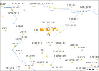
Gualanyu (Hebei, China)Gualanyu is a town in the Hebei region of China. An overview map of the region around Gualanyu is displayed below.
regional and 3d topo map of Gualanyu, China ::
Gualanyu airports ::
The nearest airport is PEK - Beijing Capital Intl, located 96.8 km west of Gualanyu.
Other airports nearby include TSN - Tianjin Binhai (131.9 km south), Nearby towns ::
Xiwoniushi (2.0km north) //
Jinshanzi (2.8km north west) //
Dongqu (3.6km south) //
Dongzhaoyaozi (4.1km north) //
Shuangguanpu (3.4km north east) //
Xi'an (4.0km west) //
Bagualing (4.9km south east) //
Jianghuyu (5.2km south west) //
Xiqu (6.9km south) //
Shangguan (7.3km south) //
Malanguan (7.8km south) //
Fenshuiling (6.8km north east) //
Shigezhuang (9.1km south) //
Shijiatai (10.1km south west) //
[all distances 'as the bird flies' and approximate] 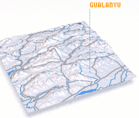 Places with similar names to Gualanyu, China ::
Disclaimer :: Information on this page comes without warranty of any kind |
||
|
Where is Gualanyu? Elevation and coordinates ::
Latitude (lat): 40°16'57"N Longitude (lon): 117°41'24"E
Elevation (approx.): 339m (map arrows pan, magnifying glasses zoom) |
||
|
Visiting Gualanyu? Hotel/Accommodation ::
Book a hotel in Gualanyu Travel Guide ::
Buy a travel guide for China rental cars ::
car rental offers GPS waypoint ::
download a GPX waypoint (PoI) of Gualanyu for your GPS receiver
|
||