|
search place name
|
||
Guangtiancun (Hainan, China)Guangtiancun is a town in the Hainan region of China. An overview map of the region around Guangtiancun is displayed below.
regional and 3d topo map of Guangtiancun, China ::
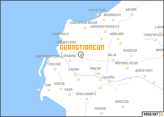
Nearby towns ::
Langbing (2.7km west) //
Chikan (4.0km south west) //
Changcheng (4.2km north west) //
Naicun (4.6km south east) //
Jubian (4.8km south) //
Yangliu (4.6km west) //
Dafeng (5.0km south east) //
Xianfeng (6.1km north east) //
Sanjia (6.2km south east) //
Changhua (6.4km north west) //
Yingxian (6.3km west) //
Wulie (6.7km east) //
Xiaozaishangcun (7.1km north) //
Danchangyuan (7.4km west) //
Wanglao (7.7km south east) //
Jiangmenkengcun (7.9km north east) //
Yuxiong (7.9km south east) //
Sigeng (8.3km south west) //
Fuma (8.6km south) //
Daolong (8.9km north east) //
Egangcun (9.0km north east) //
Shadi (10.0km north east) //
Sibi (10.2km south west) //
Baishacun (11.1km north east) //
[all distances 'as the bird flies' and approximate] 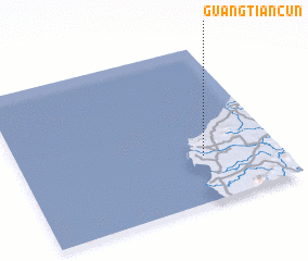 Places with similar names to Guangtiancun, China ::
Disclaimer :: Information on this page comes without warranty of any kind |
||
|
Where is Guangtiancun? Elevation and coordinates ::
Latitude (lat): 19°17'42"N Longitude (lon): 108°42'48"E
Elevation (approx.): 10m (map arrows pan, magnifying glasses zoom) |
||
|
Visiting Guangtiancun? Hotel/Accommodation ::
Book a hotel in Guangtiancun Travel Guide ::
Buy a travel guide for China rental cars ::
car rental offers GPS waypoint ::
download a GPX waypoint (PoI) of Guangtiancun for your GPS receiver
|
||