|
search place name
|
||
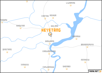
Heyetang (Hunan, China)Heyetang is a town in the Hunan region of China. An overview map of the region around Heyetang is displayed below.
regional and 3d topo map of Heyetang, China ::
Heyetang airports ::
The nearest airport is KWL - Guilin Liangjiang, located 160.3 km west of Heyetang.
Nearby towns ::
Daojiang (2.7km south) //
Wulipai (3.2km north) //
Xiaojiangkou (6.3km south) //
Meihua (6.9km north) //
Chetou (6.9km north) //
[all distances 'as the bird flies' and approximate] 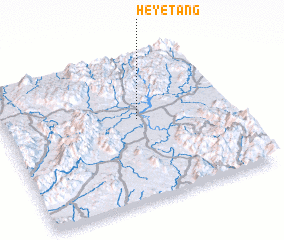 Places with similar names to Heyetang, China ::
// Hayutang (IN)
// Huayatenco (MX)
// Hahyo-dong (KP)
// Hahyu-dong (KP)
// Haya-dong (KP)
// Hayo-dong (KP)
// Heyetang (CN)
// Heyetang (CN)
Disclaimer :: Information on this page comes without warranty of any kind |
||
|
Where is Heyetang? Elevation and coordinates ::
Latitude (lat): 25°33'25"N Longitude (lon): 111°35'18"E
Elevation (approx.): 187m (map arrows pan, magnifying glasses zoom) |
||
|
Visiting Heyetang? Hotel/Accommodation ::
Book a hotel in Heyetang Travel Guide ::
Buy a travel guide for China rental cars ::
car rental offers GPS waypoint ::
download a GPX waypoint (PoI) of Heyetang for your GPS receiver
|
||