|
search place name
|
||
Canquenhê (Guinea-Bissau)Canquenhê is a town in Guinea-Bissau. An overview map of the region around Canquenhê is displayed below.
regional and 3d topo map of Canquenhê, Guinea-Bissau ::

Canquenhê airports ::
The nearest airport is BXO - Bissau Oswaldo Vieira Intl, located 136.5 km south west of Canquenhê.
Other airports nearby include TUD - Tambacounda (171.4 km north east), ZIG - Ziguinchor (190.4 km west), KLC - Kaolack (249.6 km north west), Nearby towns ::
Sare Iero Nai (0.0km north) //
Cahone (1.8km east) //
Sare Canta (1.8km west) //
Sinchã Galo (3.7km south) //
Cachá Djabè (3.7km south) //
Naima (4.1km south east) //
Cacha Fulbè (4.1km south east) //
Sare Chumbo (4.1km south west) //
Sinchã Umaro (4.1km south west) //
Cansanumã (4.1km south west) //
Sinchã Abassi (4.1km south west) //
Badumbo (4.1km south east) //
Sare Dabel (4.1km north west) //
Bantael (5.2km north west) //
Uelíngarà (5.2km north west) //
Sinchã Bojel (5.2km north west) //
Bancolene (5.7km west) //
Manatò (5.7km west) //
Mampatá (5.7km east) //
Sare Biral (6.6km north west) //
Dungal (6.6km north west) //
Sare Curael (6.6km south west) //
Jabel (6.6km north west) //
Cuncosita (6.6km north west) //
Sare Demanda (7.4km north) //
Sare Mijaca (7.4km north) //
Ongã (7.6km south) //
Fula Mori (7.6km south) //
Sare Tambá (7.8km south west) //
[all distances 'as the bird flies' and approximate] 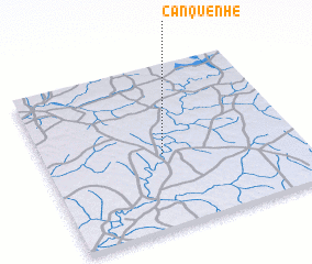 Places with similar names to Canquenhê, Guinea-Bissau ::
// Kinkinhoué (BJ)
// Kong Nhiu (LA)
// Caunguenha (MZ)
// Quang Nhiêu (VN)
// Qingnihe (CN)
// Canguinha (BR)
// Congonha (BR)
Disclaimer :: Information on this page comes without warranty of any kind |
||
|
Where is Canquenhê? Elevation and coordinates ::
Latitude (lat): 12°27'0"N Longitude (lon): 14°32'0"W
Elevation (approx.): 25m (map arrows pan, magnifying glasses zoom) |
||
|
Visiting Canquenhê? Hotel/Accommodation ::
Book a hotel in Canquenhê Travel Guide ::
rental cars ::
car rental offers GPS waypoint ::
download a GPX waypoint (PoI) of Canquenhê for your GPS receiver
|
||