|
search place name
|
||
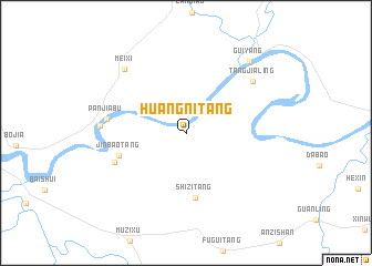
Huangnitang (Hunan, China)Huangnitang is a town in the Hunan region of China. An overview map of the region around Huangnitang is displayed below.
regional and 3d topo map of Huangnitang, China ::
Huangnitang airports ::
The nearest airport is CSX - Changcha Huanghua, located 218.5 km north east of Huangnitang.
Nearby towns ::
Shizitang (6.6km south) //
Jinbaotang (6.5km west) //
Hebutang (7.1km south west) //
Panjiabu (7.3km west) //
Tangjialing (7.9km north east) //
Panshi (7.8km west) //
Meixi (8.5km north west) //
Guiyang (9.2km north east) //
[all distances 'as the bird flies' and approximate]  Places with similar names to Huangnitang, China ::
// Hongnae-dong (KP)
// Hŭngun-dong (KP)
// Haenggun-dong (KR)
// Hongnae-dong (KR)
// Hongŭn-dong (KR)
// Huang-ni-t'ang (TW)
// Huangnidong (CN)
// Huangnitang (CN)
// Huangnitang (CN)
// Huangnitang (CN)
Disclaimer :: Information on this page comes without warranty of any kind |
||
|
Where is Huangnitang? Elevation and coordinates ::
Latitude (lat): 26°28'42"N Longitude (lon): 112°7'19"E
Elevation (approx.): 90m (map arrows pan, magnifying glasses zoom) |
||
|
Visiting Huangnitang? Hotel/Accommodation ::
Book a hotel in Huangnitang Travel Guide ::
Buy a travel guide for China rental cars ::
car rental offers GPS waypoint ::
download a GPX waypoint (PoI) of Huangnitang for your GPS receiver
|
||