|
search place name
|
||
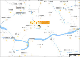
Huayangqiao (Shanghai, China)Huayangqiao is a town in the Shanghai region of China. An overview map of the region around Huayangqiao is displayed below.
regional and 3d topo map of Huayangqiao, China ::
Huayangqiao airports ::
The nearest airport is SHA - Shanghai Hongqiao Intl, located 22.2 km north of Huayangqiao.
Other airports nearby include HGH - Hangzhou Xiaoshan (117.4 km south west), NGB - Ninbo Lishe (132.2 km south), Nearby towns ::
Chedun (3.4km east) //
Songjiang (3.7km west) //
Maihuaqiao (4.8km north) //
Deshenggang (4.8km south east) //
Chengbei (5.7km north west) //
Tangkou (6.8km south west) //
Chengxi (6.3km west) //
Tangqiao (7.3km north west) //
Xinqiao (7.6km north east) //
Mishidu (7.9km south west) //
Yexie (7.9km south east) //
Zhangze (8.7km south) //
Maogang (9.4km south west) //
Guangfulin (9.7km north west) //
[all distances 'as the bird flies' and approximate] 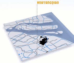 Places with similar names to Huayangqiao, China ::
// Huayuangoukou (CN)
// Huoyangoukou (CN)
Disclaimer :: Information on this page comes without warranty of any kind |
||
|
Where is Huayangqiao? Elevation and coordinates ::
Latitude (lat): 31°0'25"N Longitude (lon): 121°15'56"E
Elevation (approx.): 4m (map arrows pan, magnifying glasses zoom) |
||
|
Visiting Huayangqiao? Hotel/Accommodation ::
Book a hotel in Huayangqiao Travel Guide ::
Buy a travel guide for China rental cars ::
car rental offers GPS waypoint ::
download a GPX waypoint (PoI) of Huayangqiao for your GPS receiver
|
||