|
search place name
|
||
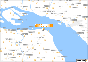
Jingliuwei (Jiangsu, China)Jingliuwei is a town in the Jiangsu region of China. An overview map of the region around Jingliuwei is displayed below.
regional and 3d topo map of Jingliuwei, China ::
Jingliuwei airports ::
The nearest airport is SHA - Shanghai Hongqiao Intl, located 105.1 km south east of Jingliuwei.
Other airports nearby include NKG - Nanjing Lukou (177.5 km west), HGH - Hangzhou Xiaoshan (196.3 km south), Nearby towns ::
Xiaobawei (1.6km east) //
Xijiegangzhen (1.9km south) //
Sanweiqiao (2.0km south west) //
Shuangqiaozhen (4.0km south) //
Yanxingtou (4.1km south west) //
Shiyiwei (4.2km west) //
Sanxing (4.7km west) //
Leyu (6.4km south) //
Shenglicun (6.3km south west) //
Huang'anwei (7.5km south) //
Yongshengsanwei (7.8km north) //
Xiaosanwei (7.3km north east) //
Tianshenggang (8.1km north east) //
Jinfeng (7.4km west) //
Nanmiaogang (8.3km south west) //
Yujiaqiao (7.8km south west) //
Xigangzhen (9.1km south west) //
Lujinggang (9.2km north east) //
Lujing (10.5km north east) //
[all distances 'as the bird flies' and approximate] 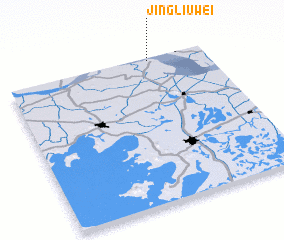 Places with similar names to Jingliuwei, China ::
// Jangalāwa (IQ)
// Jankollawa (NG)
Disclaimer :: Information on this page comes without warranty of any kind |
||
|
Where is Jingliuwei? Elevation and coordinates ::
Latitude (lat): 31°59'0"N Longitude (lon): 120°43'0"E
Elevation (approx.): 4m (map arrows pan, magnifying glasses zoom) |
||
|
Visiting Jingliuwei? Hotel/Accommodation ::
Book a hotel in Jingliuwei Travel Guide ::
Buy a travel guide for China rental cars ::
car rental offers GPS waypoint ::
download a GPX waypoint (PoI) of Jingliuwei for your GPS receiver
|
||