|
search place name
|
||
Lengshuitang (Zhejiang, China)Lengshuitang is a town in the Zhejiang region of China. An overview map of the region around Lengshuitang is displayed below.
regional and 3d topo map of Lengshuitang, China ::

Lengshuitang airports ::
The nearest airport is NGB - Ninbo Lishe, located 167.5 km north of Lengshuitang.
Other airports nearby include HGH - Hangzhou Xiaoshan (232.1 km north west), Nearby towns ::
Dalü (1.0km north west) //
Changsha (1.5km east) //
Kengyang (2.7km north) //
Shangdongqiao (3.4km north east) //
Aohuanzhen (3.7km south) //
Guan'ao (3.5km east) //
Pengjia (3.9km north west) //
Chitou (4.2km south west) //
Lin'ao (4.3km north west) //
Erzhai (4.1km east) //
Chen'ao (5.2km north east) //
Hejia (5.4km south) //
Leishi (4.9km east) //
Xiachen (4.9km west) //
Shangtang (5.5km south) //
Daleitou (5.0km west) //
Jiangwan (5.8km south) //
Yaokeng (6.0km south) //
Jiuzhitian (5.6km south west) //
Zhucun (5.6km north west) //
Xiaoquan (6.2km north west) //
Shiqiaotouzhen (6.3km north east) //
Hunan (7.0km north) //
Bailingxia (7.0km south) //
Shajiao (6.7km north east) //
Wenling (7.2km north west) //
Qianzhao (7.1km south west) //
Aodiyang (7.4km north west) //
Tutan (7.4km north east) //
[all distances 'as the bird flies' and approximate] 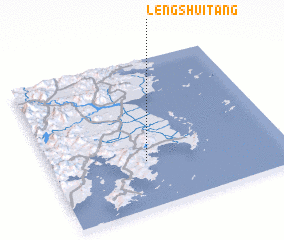 Places with similar names to Lengshuitang, China ::
// Lengshuitanqu (CN)
Disclaimer :: Information on this page comes without warranty of any kind |
||
|
Where is Lengshuitang? Elevation and coordinates ::
Latitude (lat): 28°18'59"N Longitude (lon): 121°24'19"E
Elevation (approx.): 4m (map arrows pan, magnifying glasses zoom) |
||
|
Visiting Lengshuitang? Hotel/Accommodation ::
Book a hotel in Lengshuitang Travel Guide ::
Buy a travel guide for China rental cars ::
car rental offers GPS waypoint ::
download a GPX waypoint (PoI) of Lengshuitang for your GPS receiver
|
||