|
search place name
|
||
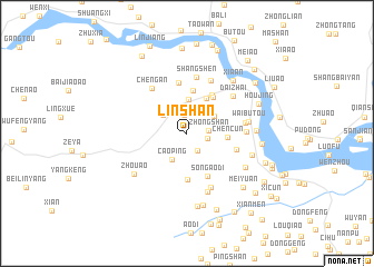
Linshan (Zhejiang, China)Linshan is a town in the Zhejiang region of China. An overview map of the region around Linshan is displayed below.
regional and 3d topo map of Linshan, China ::
Linshan airports ::
The nearest airport is MZW - Matsu Beigan, located 209.1 km south of Linshan.
Other airports nearby include NGB - Ninbo Lishe (216.9 km north east), Nearby towns ::
Xincun (1.8km north) //
Mantouzhu (2.0km south east) //
Zhongshan (1.9km east) //
Linli (1.9km east) //
Tengqiao (2.8km north west) //
Caoping (2.9km south west) //
He'ao (2.9km north east) //
Fanglong (3.5km north) //
Shangshu (3.9km north east) //
Chencun (3.6km east) //
Xiaju (4.3km north) //
Kanshang (4.3km north east) //
Shangshu (4.4km north east) //
Zhengshantou (4.7km south) //
Song'aodi (4.7km south east) //
Fenglin'ao (5.1km north) //
Zheng'ao (4.7km east) //
Shangshen (5.7km north) //
Cheng'an (5.5km north west) //
Zhouxu (5.7km north) //
Yangyi (5.2km east) //
Yangyi (5.3km east) //
Song'aohetou (5.9km south) //
Daizhai (5.6km north east) //
Guoxi (6.1km south) //
Waibutou (5.6km east) //
Zhou'ao (6.2km south west) //
Jishi (6.2km south east) //
Xiahe (6.1km east) //
[all distances 'as the bird flies' and approximate]  Places with similar names to Linshan, China ::
Disclaimer :: Information on this page comes without warranty of any kind |
||
|
Where is Linshan? Elevation and coordinates ::
Latitude (lat): 28°3'11"N Longitude (lon): 120°31'18"E
Elevation (approx.): 210m (map arrows pan, magnifying glasses zoom) |
||
|
Visiting Linshan? Hotel/Accommodation ::
Book a hotel in Linshan Travel Guide ::
Buy a travel guide for China rental cars ::
car rental offers GPS waypoint ::
download a GPX waypoint (PoI) of Linshan for your GPS receiver
|
||