|
search place name
|
||
Lubian (Zhejiang, China)Lubian is a town in the Zhejiang region of China. An overview map of the region around Lubian is displayed below.
regional and 3d topo map of Lubian, China ::

Lubian airports ::
The nearest airport is NGB - Ninbo Lishe, located 148.8 km north of Lubian.
Other airports nearby include HGH - Hangzhou Xiaoshan (216.0 km north west), Nearby towns ::
Changchangqiao (1.4km south) //
Nanyan (1.4km east) //
Gaoqiao (1.4km north east) //
Xiazheng (1.6km west) //
Shangyang (2.3km north) //
Lianshu (2.6km south west) //
Xinhezhen (2.6km east) //
Changyang (2.8km north west) //
Qiancai (3.2km south east) //
Xiaoyuluo (3.6km south west) //
Yangzhaixi (3.8km north) //
Xinqiaozhen (4.0km north) //
Lou'ao (4.4km south) //
Changyuzhen (4.5km south) //
Jiayu (4.2km south west) //
Qianda (5.0km north) //
Tiechang (5.0km south) //
Mache (4.8km south west) //
Yangtianlin (4.7km west) //
Tianyang (5.1km south west) //
Dunantou (4.9km south east) //
Caiyang (4.9km south east) //
Juanqiao (4.8km east) //
Guangming (4.8km west) //
Xialiang (5.0km north east) //
Hengjiezhen (5.6km north) //
Xintang (5.9km south east) //
Shicangxia (6.5km south) //
Daijia (6.7km north west) //
[all distances 'as the bird flies' and approximate] 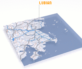 Places with similar names to Lubian, China ::
Disclaimer :: Information on this page comes without warranty of any kind |
||
|
Where is Lubian? Elevation and coordinates ::
Latitude (lat): 28°29'4"N Longitude (lon): 121°25'30"E
Elevation (approx.): 9m (map arrows pan, magnifying glasses zoom) |
||
|
Visiting Lubian? Hotel/Accommodation ::
Book a hotel in Lubian Travel Guide ::
Buy a travel guide for China rental cars ::
car rental offers GPS waypoint ::
download a GPX waypoint (PoI) of Lubian for your GPS receiver
|
||