|
search place name
|
||
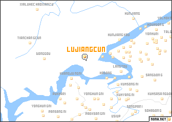
Lüjiangcun (Liaoning, China)Lüjiangcun is a town in the Liaoning region of China. An overview map of the region around Lüjiangcun is displayed below.
regional and 3d topo map of Lüjiangcun, China ::
Lüjiangcun airports ::
The nearest airport is FNJ - Pyongyang Intl, located 174.2 km south of Lüjiangcun.
Nearby towns ::
Lüjiang (2.9km east) //
Kwangjung-ni (4.5km south west) //
Sang-dong (4.4km east) //
Ha-dong (5.1km south east) //
Chung-dong (4.5km east) //
Kŭmjung-ni (5.9km south) //
Puksang-ni (5.9km south west) //
Naeyŏn-dong (6.1km south east) //
Muryŏngmal (5.8km north east) //
Langtou (6.2km east) //
Hwadae-dong (6.3km east) //
Yonghŭng-ni (8.4km south) //
Kŭmbong-ni (8.5km south) //
Hunjiangkou (7.2km north east) //
Kaesŏng-ni (8.5km south) //
Sŏngsŏ-dong (7.4km south east) //
Yongsŏ-ri (6.9km north east) //
Yongsang-ni (6.9km east) //
Kŭmch'ang-dong (8.4km south east) //
Songjŏng-ni (9.3km south east) //
Pukha-ri (9.4km south west) //
Tonggu-ri (10.0km south east) //
Yanggwich'ŏnha-dong (10.0km south east) //
Oha-ri (10.0km south east) //
Kŭmyang-ni (10.8km south east) //
[all distances 'as the bird flies' and approximate] 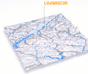 Places with similar names to Lüjiangcun, China :: Disclaimer :: Information on this page comes without warranty of any kind |
||
|
Where is Lüjiangcun? Elevation and coordinates ::
Latitude (lat): 40°47'30"N Longitude (lon): 125°36'2"E
Elevation (approx.): 156m (map arrows pan, magnifying glasses zoom) |
||
|
Visiting Lüjiangcun? Hotel/Accommodation ::
Book a hotel in Lüjiangcun Travel Guide ::
Buy a travel guide for China rental cars ::
car rental offers GPS waypoint ::
download a GPX waypoint (PoI) of Lüjiangcun for your GPS receiver
|
||