|
search place name
|
||
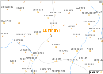
Lütingyi (Anhui, China)Lütingyi is a town in the Anhui region of China. An overview map of the region around Lütingyi is displayed below.
regional and 3d topo map of Lütingyi, China ::
Lütingyi airports ::
The nearest airport is HFE - Hefei Luogang, located 78.9 km north of Lütingyi.
Other airports nearby include NKG - Nanjing Lukou (189.4 km east), Nearby towns ::
Pingtan (1.7km south west) //
Pantou (3.9km south) //
Muqiao (4.1km north) //
Dayuan (4.5km west) //
Dahuangjingben (5.8km north east) //
Jiepaishi (6.9km north) //
Hongmiao (7.0km south east) //
Xindian (7.0km north east) //
Sanshilipu (8.1km north) //
Wangguolu (7.9km south west) //
Gaoqiaozhen (9.0km south) //
Wulifang (9.0km south) //
Tongcheng (8.8km south west) //
Miaogang (10.3km north east) //
Da'an (10.6km south west) //
Qinglian'an (10.6km south west) //
[all distances 'as the bird flies' and approximate] 
Disclaimer :: Information on this page comes without warranty of any kind |
||
|
Where is Lütingyi? Elevation and coordinates ::
Latitude (lat): 31°6'48"N Longitude (lon): 117°0'35"E
Elevation (approx.): 41m (map arrows pan, magnifying glasses zoom) |
||
|
Visiting Lütingyi? Hotel/Accommodation ::
Book a hotel in Lütingyi Travel Guide ::
Buy a travel guide for China rental cars ::
car rental offers GPS waypoint ::
download a GPX waypoint (PoI) of Lütingyi for your GPS receiver
|
||