|
search place name
|
||
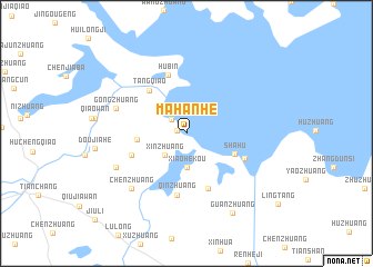
Mahanhe (Anhui, China)Mahanhe is a town in the Anhui region of China. An overview map of the region around Mahanhe is displayed below.
regional and 3d topo map of Mahanhe, China ::
Mahanhe airports ::
The nearest airport is NKG - Nanjing Lukou, located 114.4 km south of Mahanhe.
Other airports nearby include HFE - Hefei Luogang (203.4 km south west), Nearby towns ::
Liuzhuang (0.9km west) //
Xinhekou (1.8km north west) //
Xinzhuang (2.8km south west) //
Xiaohekou (3.4km south) //
Dakuangweinongchang (4.2km west) //
Shahu (4.6km south east) //
Tangqiao (5.3km north west) //
Wanshou (5.1km south west) //
Jiepaizhen (5.8km south) //
Hubin (6.1km north) //
Qinzhuang (6.2km south) //
Dawangzhuang (5.5km south east) //
Gongzhuang (6.5km west) //
Chenzhuang (7.3km south west) //
Lizhuang (6.9km south west) //
Guanzhuang (8.9km south east) //
[all distances 'as the bird flies' and approximate] 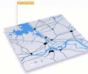
Disclaimer :: Information on this page comes without warranty of any kind |
||
|
Where is Mahanhe? Elevation and coordinates ::
Latitude (lat): 32°44'50"N Longitude (lon): 119°8'0"E
Elevation (approx.): 11m (map arrows pan, magnifying glasses zoom) |
||
|
Visiting Mahanhe? Hotel/Accommodation ::
Book a hotel in Mahanhe Travel Guide ::
Buy a travel guide for China rental cars ::
car rental offers GPS waypoint ::
download a GPX waypoint (PoI) of Mahanhe for your GPS receiver
|
||