|
search place name
|
||
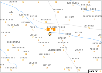
Minzhu (Anhui, China)Minzhu is a town in the Anhui region of China. An overview map of the region around Minzhu is displayed below.
regional and 3d topo map of Minzhu, China ::
Minzhu airports ::
The nearest airport is HFE - Hefei Luogang, located 168.1 km south of Minzhu.
Other airports nearby include NKG - Nanjing Lukou (242.5 km south east), Nearby towns ::
Menxiyangzhuang (2.9km north east) //
Nianzhuang (3.9km south west) //
Junwang (3.7km south east) //
Daying (4.1km west) //
Fangdian (4.2km north east) //
Huzhuang (5.5km north) //
Guanlukou (5.0km south east) //
Daliaozhuang (6.0km south) //
Wanwei (5.4km east) //
Yangji (5.4km west) //
Chenji (6.3km south east) //
Chenli (6.0km north west) //
Hanzhuang (7.7km south) //
Shiliwang (8.2km north east) //
Daying (8.4km north west) //
Shiliwang (8.4km north east) //
[all distances 'as the bird flies' and approximate] 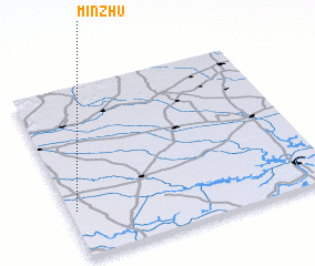 Places with similar names to Minzhu, China ::
// Mān Sao-haw (MM)
// Manosahe (TP)
// Miāna Saho (PK)
// Mianzhi (CN)
// Mianzhu (CN)
// Minzhu (CN)
// Minzhu (CN)
// Minzhu (CN)
// Minzhu (CN)
// Minzhu (CN)
Disclaimer :: Information on this page comes without warranty of any kind |
||
|
Where is Minzhu? Elevation and coordinates ::
Latitude (lat): 33°16'40"N Longitude (lon): 117°1'30"E
Elevation (approx.): 26m (map arrows pan, magnifying glasses zoom) |
||
|
Visiting Minzhu? Hotel/Accommodation ::
Book a hotel in Minzhu Travel Guide ::
Buy a travel guide for China rental cars ::
car rental offers GPS waypoint ::
download a GPX waypoint (PoI) of Minzhu for your GPS receiver
|
||