|
search place name
|
||
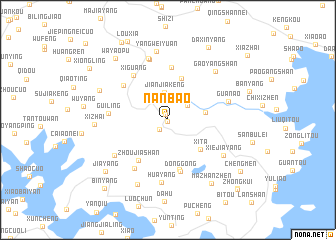
Nanbao (Zhejiang, China)Nanbao is a town in the Zhejiang region of China. An overview map of the region around Nanbao is displayed below.
regional and 3d topo map of Nanbao, China ::
Nanbao airports ::
The nearest airport is MZW - Matsu Beigan, located 129.2 km south of Nanbao.
Other airports nearby include FOC - Fuzhou Changle (171.7 km south west), Nearby towns ::
Zhongcun (0.2km south) //
Nanxia (0.6km north) //
Yuanpan (1.3km south west) //
Fanshanzhen (1.4km north west) //
Beishan (2.5km north east) //
Jianjiakeng (3.1km north) //
Fengyang (3.9km east) //
Changchan (4.8km north) //
Xita (4.6km south east) //
Zhoujiashan (5.4km south west) //
Dailingshezuxiang (5.7km south) //
Wangjiayang (5.9km north) //
Donggong (5.9km south) //
Xiguang (6.0km north west) //
Puping (5.9km north west) //
Jiashan (6.3km south west) //
Guiling (5.9km west) //
Huayang (7.0km south) //
Beishan (7.0km north) //
Guan'ao (6.4km east) //
Nansong (7.1km north) //
Sumuyang (6.7km south west) //
Xiejiayang (6.8km south east) //
Gaoyangshan (7.2km north east) //
Yangweiyuan (7.7km north) //
Houyang (7.8km south west) //
Xizhai (7.3km west) //
Fengtong (7.6km north west) //
Mazhanzhen (8.3km south east) //
[all distances 'as the bird flies' and approximate] 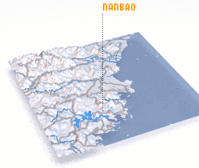 Places with similar names to Nanbao, China ::
Disclaimer :: Information on this page comes without warranty of any kind |
||
|
Where is Nanbao? Elevation and coordinates ::
Latitude (lat): 27°19'49"N Longitude (lon): 120°24'46"E
Elevation (approx.): 354m (map arrows pan, magnifying glasses zoom) |
||
|
Visiting Nanbao? Hotel/Accommodation ::
Book a hotel in Nanbao Travel Guide ::
Buy a travel guide for China rental cars ::
car rental offers GPS waypoint ::
download a GPX waypoint (PoI) of Nanbao for your GPS receiver
|
||