|
search place name
|
||
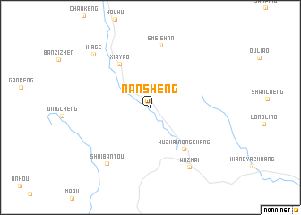
Nansheng (Fujian, China)Nansheng is a town in the Fujian region of China. An overview map of the region around Nansheng is displayed below.
regional and 3d topo map of Nansheng, China ::
Nansheng airports ::
The nearest airport is XMN - Xiamen Gaoqi, located 85.2 km north east of Nansheng.
Other airports nearby include KNH - Chinmen Shang Yi (103.6 km east), Nearby towns ::
Xiayao (6.4km north west) //
Wuzhainongchang (6.4km south east) //
Emeishan (7.8km north) //
Shuibantou (8.6km south west) //
Wuzhai (8.7km south east) //
Xiage (9.3km north west) //
[all distances 'as the bird flies' and approximate] 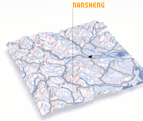 Places with similar names to Nansheng, China ::
// Nantiango (BJ)
// Nancheng (CN)
// Nan-ching (TW)
// Nan-chuang (TW)
// Nan-chuang (TW)
// Nan-ch'ang (TW)
// Nan-sheng (TW)
// Nan-ch'ang (TW)
// Nan-chuang (TW)
// Nainiuchang (CN)
Disclaimer :: Information on this page comes without warranty of any kind |
||
|
Where is Nansheng? Elevation and coordinates ::
Latitude (lat): 24°13'40"N Longitude (lon): 117°21'42"E
Elevation (approx.): 72m (map arrows pan, magnifying glasses zoom) |
||
|
Visiting Nansheng? Hotel/Accommodation ::
Book a hotel in Nansheng Travel Guide ::
Buy a travel guide for China rental cars ::
car rental offers GPS waypoint ::
download a GPX waypoint (PoI) of Nansheng for your GPS receiver
|
||