|
search place name
|
||
Nantian (Hainan, China)Nantian is a town in the Hainan region of China. An overview map of the region around Nantian is displayed below.
regional and 3d topo map of Nantian, China ::

Nearby towns ::
Baizhang (3.1km south) //
Fanjie (4.4km west) //
Fanman (4.6km north east) //
Bianwencun (5.4km north) //
Fansai (5.4km west) //
Hongshan (7.2km west) //
Tongshen (9.6km south west) //
Maoxiang (9.5km south east) //
Chongshan (10.0km south west) //
Chongshan (10.4km south west) //
[all distances 'as the bird flies' and approximate] 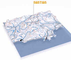 Places with similar names to Nantian, China ::
// Nan Chaîne (HT)
// Nantian (CN)
// Nanch'ŏn-ni (KP)
// Nan'aoshan (CN)
// Nan-chien (TW)
// Nan-sheng-hu (TW)
// Nan-shan (TW)
// Nanshan (CN)
// Nanshan (CN)
// Nanatian (PH)
Disclaimer :: Information on this page comes without warranty of any kind |
||
|
Where is Nantian? Elevation and coordinates ::
Latitude (lat): 18°50'50"N Longitude (lon): 109°35'3"E
Elevation (approx.): 643m (map arrows pan, magnifying glasses zoom) |
||
|
Visiting Nantian? Hotel/Accommodation ::
Book a hotel in Nantian Travel Guide ::
Buy a travel guide for China rental cars ::
car rental offers GPS waypoint ::
download a GPX waypoint (PoI) of Nantian for your GPS receiver
|
||