|
search place name
|
||
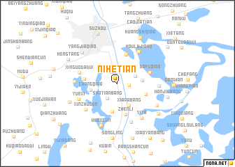
Nihetian (Jiangsu, China)Nihetian is a town in the Jiangsu region of China. An overview map of the region around Nihetian is displayed below.
regional and 3d topo map of Nihetian, China ::
Nihetian airports ::
The nearest airport is SHA - Shanghai Hongqiao Intl, located 65.9 km east of Nihetian.
Other airports nearby include HGH - Hangzhou Xiaoshan (113.8 km south), NGB - Ninbo Lishe (175.1 km south east), NKG - Nanjing Lukou (178.5 km west), Nearby towns ::
Yinshan (1.6km east) //
Changbangcun (2.5km north) //
Shatianbang (2.8km south west) //
Guogang (2.7km north east) //
Wulongqiao (3.2km north west) //
Xiapabang (3.8km south east) //
Yinshanhunongchang (3.5km east) //
Changqiao (3.8km west) //
Yaojiazhuang (4.5km south) //
Xujiabang (4.2km south east) //
Dadangli (4.8km north) //
Zhenli (5.1km south) //
Chenjiacun (4.6km west) //
Dafuqiao (4.7km east) //
Houlujiaku (5.8km north east) //
Xinguodadui (5.5km west) //
Zhaojiatan (6.4km south) //
Xinzhucun (6.1km south west) //
Hengliaojing (5.7km east) //
Yuexi (5.8km south west) //
Yita (6.4km south east) //
Zhanxia (5.9km west) //
Wubucun (7.1km south) //
Liupudadui (6.5km south east) //
Yangjiaqiao (6.9km north west) //
Majiabang (7.4km south east) //
Wushantou (7.2km south west) //
Huangshiqiao (8.0km north east) //
Hanjiabang (7.2km east) //
[all distances 'as the bird flies' and approximate]  Places with similar names to Nihetian, China ::
// Noha-ch'on (KP)
// Noha-ch'on (KP)
Disclaimer :: Information on this page comes without warranty of any kind |
||
|
Where is Nihetian? Elevation and coordinates ::
Latitude (lat): 31°14'23"N Longitude (lon): 120°38'48"E
Elevation (approx.): 8m (map arrows pan, magnifying glasses zoom) |
||
|
Visiting Nihetian? Hotel/Accommodation ::
Book a hotel in Nihetian Travel Guide ::
Buy a travel guide for China rental cars ::
car rental offers GPS waypoint ::
download a GPX waypoint (PoI) of Nihetian for your GPS receiver
|
||