|
search place name
|
||
Qingtang (Jiangxi, China)Qingtang is a town in the Jiangxi region of China. An overview map of the region around Qingtang is displayed below.
regional and 3d topo map of Qingtang, China ::
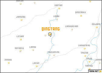
Nearby towns ::
Chenye (1.9km west) //
Laobu (6.6km north) //
Youcunping (7.0km south) //
Lianhuashan (7.4km east) //
Lianhu (7.7km south west) //
[all distances 'as the bird flies' and approximate] 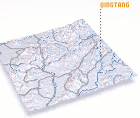 Places with similar names to Qingtang, China ::
// Cancadong (PH)
// Cangadieng (PH)
// Cang Atong (PH)
// Kaounga Dounga (CG)
// Gangtengah (ID)
// Kang-dong (KP)
// Kang-dong (KP)
// Kanggu-dong (KP)
// Kanggu-dong (KP)
// Kaong-dong (KP)
Disclaimer :: Information on this page comes without warranty of any kind |
||
|
Where is Qingtang? Elevation and coordinates ::
Latitude (lat): 26°26'43"N Longitude (lon): 115°51'51"E
Elevation (approx.): 211m (map arrows pan, magnifying glasses zoom) |
||
|
Visiting Qingtang? Hotel/Accommodation ::
Book a hotel in Qingtang Travel Guide ::
Buy a travel guide for China rental cars ::
car rental offers GPS waypoint ::
download a GPX waypoint (PoI) of Qingtang for your GPS receiver
|
||