|
search place name
|
||
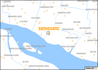
Sanhegang (Jiangsu, China)Sanhegang is a town in the Jiangsu region of China. An overview map of the region around Sanhegang is displayed below.
regional and 3d topo map of Sanhegang, China ::
Sanhegang airports ::
The nearest airport is SHA - Shanghai Hongqiao Intl, located 70.7 km south of Sanhegang.
Other airports nearby include HGH - Hangzhou Xiaoshan (204.1 km south west), NGB - Ninbo Lishe (220.7 km south), Nearby towns ::
Beixinzhen (0.7km north) //
Beixin (2.3km north west) //
Qidonggang (2.5km west) //
Xingang (4.7km north east) //
Huangcangzhen (5.6km north west) //
Juexin (5.8km north west) //
Pujizhen (6.8km north west) //
Xinglongnongchang (6.8km south west) //
Gaojiazhen (6.4km east) //
Xinqiaozhen (8.4km north) //
Yonglonggang (8.4km south east) //
Dashengzhen (9.0km north east) //
[all distances 'as the bird flies' and approximate]  Places with similar names to Sanhegang, China ::
// Sinhakaung (MM)
Disclaimer :: Information on this page comes without warranty of any kind |
||
|
Where is Sanhegang? Elevation and coordinates ::
Latitude (lat): 31°49'0"N Longitude (lon): 121°31'0"E
Elevation (approx.): 4m (map arrows pan, magnifying glasses zoom) |
||
|
Visiting Sanhegang? Hotel/Accommodation ::
Book a hotel in Sanhegang Travel Guide ::
Buy a travel guide for China rental cars ::
car rental offers GPS waypoint ::
download a GPX waypoint (PoI) of Sanhegang for your GPS receiver
|
||