|
search place name
|
||
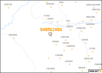
Shangzhou (Zhejiang, China)Shangzhou is a town in the Zhejiang region of China. An overview map of the region around Shangzhou is displayed below.
regional and 3d topo map of Shangzhou, China ::
Shangzhou airports ::
The nearest airport is NGB - Ninbo Lishe, located 173.9 km north east of Shangzhou.
Other airports nearby include HGH - Hangzhou Xiaoshan (175.3 km north), Nearby towns ::
Xinhua (3.3km south east) //
Sanxi (5.4km north) //
Yuechen (4.9km east) //
Houren (5.8km north) //
Yating (6.0km south east) //
Xiying (6.7km north) //
Zhangyuan (6.6km south east) //
Gaoyu (6.7km east) //
Yaxi (7.2km north east) //
Huangliankeng (7.9km south) //
Linghou (8.5km south) //
Gaofan (8.1km south east) //
[all distances 'as the bird flies' and approximate]  Places with similar names to Shangzhou, China ::
// Shynqozha (KZ)
// Shang-ssu-hu (TW)
// Shangzhou'ao (CN)
// Changzhai (CN)
// Changzhai (CN)
// Changzhai (CN)
// Changzhai (CN)
// Changzhai (CN)
// Changzhao (CN)
// Changzhao (CN)
Disclaimer :: Information on this page comes without warranty of any kind |
||
|
Where is Shangzhou? Elevation and coordinates ::
Latitude (lat): 28°39'15"N Longitude (lon): 120°16'26"E
Elevation (approx.): 319m (map arrows pan, magnifying glasses zoom) |
||
|
Visiting Shangzhou? Hotel/Accommodation ::
Book a hotel in Shangzhou Travel Guide ::
Buy a travel guide for China rental cars ::
car rental offers GPS waypoint ::
download a GPX waypoint (PoI) of Shangzhou for your GPS receiver
|
||