|
search place name
|
||
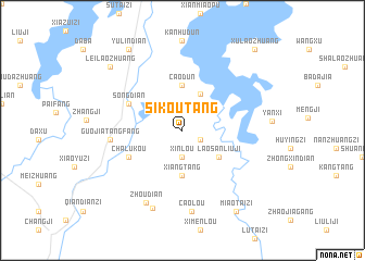
Sikoutang (Anhui, China)Sikoutang is a town in the Anhui region of China. An overview map of the region around Sikoutang is displayed below.
regional and 3d topo map of Sikoutang, China ::
Sikoutang airports ::
The nearest airport is HFE - Hefei Luogang, located 105.5 km south east of Sikoutang.
Nearby towns ::
Sanliuji (1.8km south east) //
Xinlou (2.8km south) //
Dawangpeng (4.0km north east) //
Xiangtang (4.6km south) //
Caodun (4.6km north) //
Laosanliuji (4.2km south east) //
Chalukou (5.5km south west) //
Songdian (5.5km north west) //
Guojiatangfang (6.3km west) //
Zhoudian (8.1km south west) //
Caolou (8.4km south) //
Zhoudian (8.4km south) //
Leilaozhuang (9.0km north west) //
Yulindian (9.6km north west) //
Miaotaizi (9.6km south east) //
Xulaozhuang (10.4km north east) //
[all distances 'as the bird flies' and approximate] 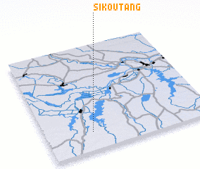 Places with similar names to Sikoutang, China ::
// Saco da Onça (BR)
// Saco da Onça (BR)
// Saco da Onça (BR)
// Sagadaung (MM)
// Sagade Anauk (MM)
// Saigahtawng (MM)
// Schütting (DE)
// Skotnica (PL)
// Skotnica (PL)
// Skotnik (PL)
Disclaimer :: Information on this page comes without warranty of any kind |
||
|
Where is Sikoutang? Elevation and coordinates ::
Latitude (lat): 32°10'30"N Longitude (lon): 116°17'0"E
Elevation (approx.): 27m (map arrows pan, magnifying glasses zoom) |
||
|
Visiting Sikoutang? Hotel/Accommodation ::
Book a hotel in Sikoutang Travel Guide ::
Buy a travel guide for China rental cars ::
car rental offers GPS waypoint ::
download a GPX waypoint (PoI) of Sikoutang for your GPS receiver
|
||