|
search place name
|
||
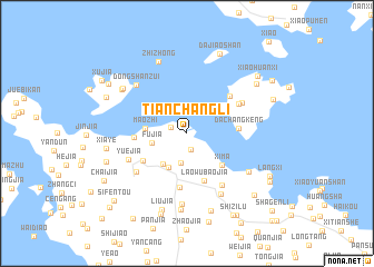
Tianchangli (Zhejiang, China)Tianchangli is a town in the Zhejiang region of China. An overview map of the region around Tianchangli is displayed below.
regional and 3d topo map of Tianchangli, China ::
Tianchangli airports ::
The nearest airport is NGB - Ninbo Lishe, located 71.4 km south west of Tianchangli.
Other airports nearby include SHA - Shanghai Hongqiao Intl (138.1 km north west), HGH - Hangzhou Xiaoshan (161.2 km west), Nearby towns ::
Zhengjia (1.7km south) //
Lijiaqiwai (1.5km north west) //
Shizikeng (3.0km south) //
Fujia (3.2km west) //
Maʼao (3.7km south west) //
Tiannongli (3.7km south west) //
Maozhi (3.6km west) //
Xima (4.4km south east) //
Laowubaojia (4.9km south) //
Chenjia (4.7km south west) //
Dachangkeng (4.5km east) //
Qitou (4.6km west) //
Longtankeng (5.5km south) //
Liangmaoshan (5.2km north east) //
Wuyantou (5.4km north east) //
Ganlan (6.0km south east) //
Shenjia (5.7km north east) //
Xiaosha (5.8km south west) //
Yuejia (5.7km south west) //
Lixinwu (6.8km south east) //
Dongshanzui (6.6km north west) //
Changchunling (7.2km south) //
Jingtouʼao (6.6km south east) //
Chenjia (7.7km south) //
Zhizhong (7.6km north) //
Shadili (7.2km north west) //
Dawan (7.2km north west) //
Liujia (7.9km south) //
Houʼao (8.0km south) //
[all distances 'as the bird flies' and approximate] 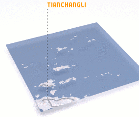 Places with similar names to Tianchangli, China ::
// Ch'en-ching-liao (TW)
// Shanshanglei (CN)
Disclaimer :: Information on this page comes without warranty of any kind |
||
|
Where is Tianchangli? Elevation and coordinates ::
Latitude (lat): 30°8'40"N Longitude (lon): 122°6'21"E
Elevation (approx.): 15m (map arrows pan, magnifying glasses zoom) |
||
|
Visiting Tianchangli? Hotel/Accommodation ::
Book a hotel in Tianchangli Travel Guide ::
Buy a travel guide for China rental cars ::
car rental offers GPS waypoint ::
download a GPX waypoint (PoI) of Tianchangli for your GPS receiver
|
||