|
search place name
|
||
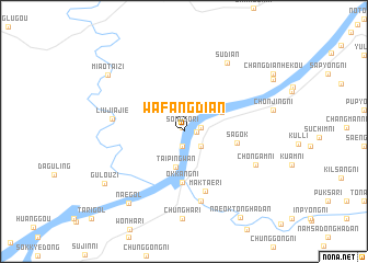
Wafangdian (Liaoning, China)Wafangdian is a town in the Liaoning region of China. An overview map of the region around Wafangdian is displayed below.
regional and 3d topo map of Wafangdian, China ::
Wafangdian airports ::
The nearest airport is FNJ - Pyongyang Intl, located 149.8 km south east of Wafangdian.
Nearby towns ::
Sŏngsŏ-ri (0.4km north) //
Pangsan-ni (1.0km east) //
Namsan-ni (1.5km south) //
Sŏngjung-ni (1.4km east) //
Mokch'aeng-ni (2.0km south east) //
Nammunoe (2.0km south east) //
Taipingwan (3.7km south) //
Yŏnwŏl-li (3.5km north east) //
Okkang-ni (5.2km south) //
Ipsŏng-ni (5.2km south) //
Sagok (4.3km east) //
Maktae-ri (6.3km south) //
Kŏmdae-ri (7.2km south) //
Liujiajie (5.7km west) //
Ch'ŏn'gam-ni (6.5km south east) //
Sudian (7.7km north east) //
Naegol (8.5km south west) //
Gulouzi (8.2km south west) //
Miaotaizi (8.3km north west) //
Naeoktong-Hadan (9.8km south east) //
[all distances 'as the bird flies' and approximate] 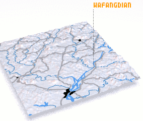 Places with similar names to Wafangdian, China ::
Disclaimer :: Information on this page comes without warranty of any kind |
||
|
Where is Wafangdian? Elevation and coordinates ::
Latitude (lat): 40°21'49"N Longitude (lon): 124°44'4"E
Elevation (approx.): 27m (map arrows pan, magnifying glasses zoom) |
||
|
Visiting Wafangdian? Hotel/Accommodation ::
Book a hotel in Wafangdian Travel Guide ::
Buy a travel guide for China rental cars ::
car rental offers GPS waypoint ::
download a GPX waypoint (PoI) of Wafangdian for your GPS receiver
|
||