|
search place name
|
||
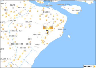
Wujia (Zhejiang, China)Wujia is a town in the Zhejiang region of China. An overview map of the region around Wujia is displayed below.
regional and 3d topo map of Wujia, China ::
Wujia airports ::
The nearest airport is MZW - Matsu Beigan, located 199.3 km south west of Wujia.
Other airports nearby include NGB - Ninbo Lishe (225.7 km north), FOC - Fuzhou Changle (242.8 km south west), Nearby towns ::
Meitouzhen (0.0km north) //
Sijia (0.6km south) //
Zhengzhai (0.9km north west) //
Liuzhai (1.1km north) //
Qijia (1.4km north east) //
Sanjia (1.4km south west) //
Doushan (1.9km north) //
Houjin (1.9km south west) //
Bajia (2.1km north east) //
Yongxingzhen (3.0km north east) //
Xincheng (3.1km north) //
Zhuangquanxia (3.2km south west) //
Erjia (3.2km south west) //
Lingbeiyang (3.2km south west) //
Tianzhusi (3.1km west) //
Sanjiapu (3.7km south) //
Yongchangzhen (3.7km north east) //
Dantou (3.8km north) //
Zhuangquan (3.8km south west) //
Shuang'ao (4.0km north west) //
Sunyang (4.1km north) //
Zheng'ao (3.8km west) //
Xiayangjie (4.0km north east) //
Yongqiang (4.5km north) //
Pumen (4.5km south) //
Xiaotangxia (4.4km north east) //
Xingqianjie (4.7km north east) //
Xiazhaigang (4.3km east) //
Chanzhong (4.9km north east) //
[all distances 'as the bird flies' and approximate] 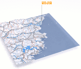 Places with similar names to Wujia, China ::
Disclaimer :: Information on this page comes without warranty of any kind |
||
|
Where is Wujia? Elevation and coordinates ::
Latitude (lat): 27°52'34"N Longitude (lon): 120°47'48"E
Elevation (approx.): 10m (map arrows pan, magnifying glasses zoom) |
||
|
Visiting Wujia? Hotel/Accommodation ::
Book a hotel in Wujia Travel Guide ::
Buy a travel guide for China rental cars ::
car rental offers GPS waypoint ::
download a GPX waypoint (PoI) of Wujia for your GPS receiver
|
||